You are here: Home > Network List > TA - USArray Transportable Network (new EarthScope stations) Stations List
> Station J04D Umpqua National Forest, Toketee, OR, USA > Earthquake Result Viewer
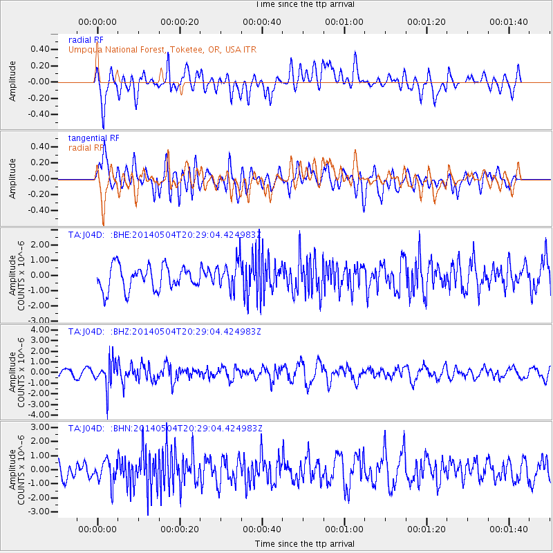
J04D Umpqua National Forest, Toketee, OR, USA - Earthquake Result Viewer
*The percent match for this event was below the threshold and hence no stack was calculated.
| Earthquake location: |
Near S. Coast Of Honshu, Japan |
| Earthquake latitude/longitude: |
34.9/139.3 |
| Earthquake time(UTC): |
2014/05/04 (124) 20:18:25 GMT |
| Earthquake Depth: |
156 km |
| Earthquake Magnitude: |
5.8 MB |
| Earthquake Catalog/Contributor: |
NEIC PDE/NEIC COMCAT |
|
| Network: |
TA USArray Transportable Network (new EarthScope stations) |
| Station: |
J04D Umpqua National Forest, Toketee, OR, USA |
| Lat/Lon: |
43.24 N/122.11 W |
| Elevation: |
1948 m |
|
| Distance: |
72.6 deg |
| Az: |
49.227 deg |
| Baz: |
301.589 deg |
| Ray Param: |
$rayparam |
*The percent match for this event was below the threshold and hence was not used in the summary stack. |
|
| Radial Match: |
66.35083 % |
| Radial Bump: |
400 |
| Transverse Match: |
63.077347 % |
| Transverse Bump: |
400 |
| SOD ConfigId: |
626651 |
| Insert Time: |
2014-05-18 21:11:14.579 +0000 |
| GWidth: |
2.5 |
| Max Bumps: |
400 |
| Tol: |
0.001 |
|
Signal To Noise
| Channel | StoN | STA | LTA |
| TA:J04D: :BHZ:20140504T20:29:04.424983Z | 3.1771355 | 1.2582095E-6 | 3.960201E-7 |
| TA:J04D: :BHN:20140504T20:29:04.424983Z | 1.3758575 | 8.407263E-7 | 6.110562E-7 |
| TA:J04D: :BHE:20140504T20:29:04.424983Z | 1.2116416 | 9.4488485E-7 | 7.798386E-7 |
| Arrivals |
| Ps | |
| PpPs | |
| PsPs/PpSs | |


