You are here: Home > Network List > TA - USArray Transportable Network (new EarthScope stations) Stations List
> Station J49A Marlette, MI, USA > Earthquake Result Viewer
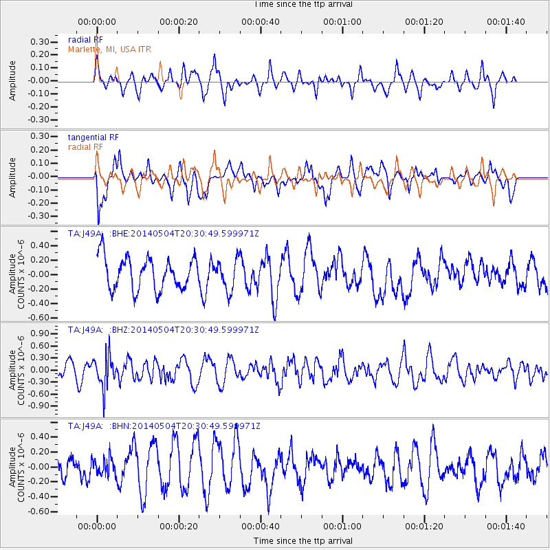
J49A Marlette, MI, USA - Earthquake Result Viewer
*The percent match for this event was below the threshold and hence no stack was calculated.
| Earthquake location: |
Near S. Coast Of Honshu, Japan |
| Earthquake latitude/longitude: |
34.9/139.3 |
| Earthquake time(UTC): |
2014/05/04 (124) 20:18:25 GMT |
| Earthquake Depth: |
156 km |
| Earthquake Magnitude: |
5.8 MB |
| Earthquake Catalog/Contributor: |
NEIC PDE/NEIC COMCAT |
|
| Network: |
TA USArray Transportable Network (new EarthScope stations) |
| Station: |
J49A Marlette, MI, USA |
| Lat/Lon: |
43.36 N/83.14 W |
| Elevation: |
253 m |
|
| Distance: |
93.0 deg |
| Az: |
29.539 deg |
| Baz: |
326.245 deg |
| Ray Param: |
$rayparam |
*The percent match for this event was below the threshold and hence was not used in the summary stack. |
|
| Radial Match: |
38.708656 % |
| Radial Bump: |
296 |
| Transverse Match: |
56.968605 % |
| Transverse Bump: |
400 |
| SOD ConfigId: |
626651 |
| Insert Time: |
2014-05-18 21:11:23.743 +0000 |
| GWidth: |
2.5 |
| Max Bumps: |
400 |
| Tol: |
0.001 |
|
Signal To Noise
| Channel | StoN | STA | LTA |
| TA:J49A: :BHZ:20140504T20:30:49.599971Z | 2.6503756 | 3.9956555E-7 | 1.5075808E-7 |
| TA:J49A: :BHN:20140504T20:30:49.599971Z | 0.6141504 | 1.1181394E-7 | 1.8206279E-7 |
| TA:J49A: :BHE:20140504T20:30:49.599971Z | 0.9868219 | 2.196587E-7 | 2.2259204E-7 |
| Arrivals |
| Ps | |
| PpPs | |
| PsPs/PpSs | |


