You are here: Home > Network List > TA - USArray Transportable Network (new EarthScope stations) Stations List
> Station L04D Klamath Falls, OR, USA > Earthquake Result Viewer
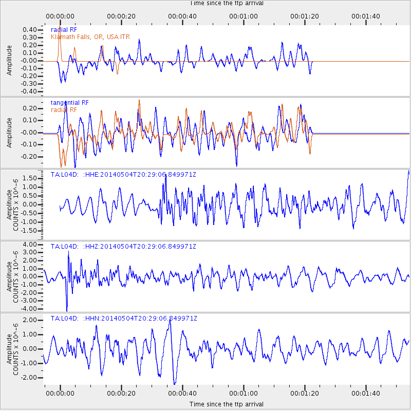
L04D Klamath Falls, OR, USA - Earthquake Result Viewer
*The percent match for this event was below the threshold and hence no stack was calculated.
| Earthquake location: |
Near S. Coast Of Honshu, Japan |
| Earthquake latitude/longitude: |
34.9/139.3 |
| Earthquake time(UTC): |
2014/05/04 (124) 20:18:25 GMT |
| Earthquake Depth: |
156 km |
| Earthquake Magnitude: |
5.8 MB |
| Earthquake Catalog/Contributor: |
NEIC PDE/NEIC COMCAT |
|
| Network: |
TA USArray Transportable Network (new EarthScope stations) |
| Station: |
L04D Klamath Falls, OR, USA |
| Lat/Lon: |
42.22 N/122.30 W |
| Elevation: |
1437 m |
|
| Distance: |
73.0 deg |
| Az: |
50.216 deg |
| Baz: |
301.749 deg |
| Ray Param: |
$rayparam |
*The percent match for this event was below the threshold and hence was not used in the summary stack. |
|
| Radial Match: |
44.271675 % |
| Radial Bump: |
354 |
| Transverse Match: |
63.907658 % |
| Transverse Bump: |
400 |
| SOD ConfigId: |
626651 |
| Insert Time: |
2014-05-18 21:11:56.668 +0000 |
| GWidth: |
2.5 |
| Max Bumps: |
400 |
| Tol: |
0.001 |
|
Signal To Noise
| Channel | StoN | STA | LTA |
| TA:L04D: :HHZ:20140504T20:29:06.849971Z | 2.6468759 | 1.3445367E-6 | 5.079712E-7 |
| TA:L04D: :HHN:20140504T20:29:06.849971Z | 0.40335077 | 2.9271456E-7 | 7.257072E-7 |
| TA:L04D: :HHE:20140504T20:29:06.849971Z | 1.3574436 | 6.2778105E-7 | 4.6247305E-7 |
| Arrivals |
| Ps | |
| PpPs | |
| PsPs/PpSs | |


