You are here: Home > Network List > TA - USArray Transportable Network (new EarthScope stations) Stations List
> Station L48A N Adams, MI, USA > Earthquake Result Viewer
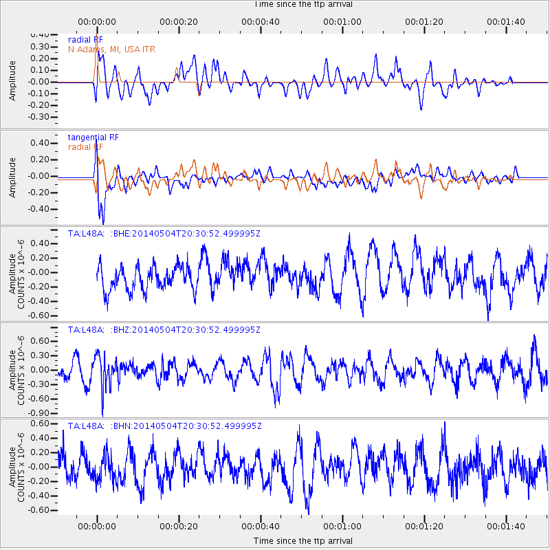
L48A N Adams, MI, USA - Earthquake Result Viewer
*The percent match for this event was below the threshold and hence no stack was calculated.
| Earthquake location: |
Near S. Coast Of Honshu, Japan |
| Earthquake latitude/longitude: |
34.9/139.3 |
| Earthquake time(UTC): |
2014/05/04 (124) 20:18:25 GMT |
| Earthquake Depth: |
156 km |
| Earthquake Magnitude: |
5.8 MB |
| Earthquake Catalog/Contributor: |
NEIC PDE/NEIC COMCAT |
|
| Network: |
TA USArray Transportable Network (new EarthScope stations) |
| Station: |
L48A N Adams, MI, USA |
| Lat/Lon: |
41.94 N/84.43 W |
| Elevation: |
369 m |
|
| Distance: |
93.7 deg |
| Az: |
31.127 deg |
| Baz: |
325.279 deg |
| Ray Param: |
$rayparam |
*The percent match for this event was below the threshold and hence was not used in the summary stack. |
|
| Radial Match: |
47.575554 % |
| Radial Bump: |
400 |
| Transverse Match: |
67.97344 % |
| Transverse Bump: |
400 |
| SOD ConfigId: |
626651 |
| Insert Time: |
2014-05-18 21:12:04.317 +0000 |
| GWidth: |
2.5 |
| Max Bumps: |
400 |
| Tol: |
0.001 |
|
Signal To Noise
| Channel | StoN | STA | LTA |
| TA:L48A: :BHZ:20140504T20:30:52.499995Z | 2.4367409 | 3.230771E-7 | 1.3258574E-7 |
| TA:L48A: :BHN:20140504T20:30:52.499995Z | 1.0906111 | 1.7815276E-7 | 1.6335132E-7 |
| TA:L48A: :BHE:20140504T20:30:52.499995Z | 1.1622691 | 1.9002802E-7 | 1.6349743E-7 |
| Arrivals |
| Ps | |
| PpPs | |
| PsPs/PpSs | |


