You are here: Home > Network List > TA - USArray Transportable Network (new EarthScope stations) Stations List
> Station N02D Trinity Center, CA, USA > Earthquake Result Viewer
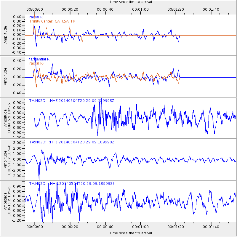
N02D Trinity Center, CA, USA - Earthquake Result Viewer
*The percent match for this event was below the threshold and hence no stack was calculated.
| Earthquake location: |
Near S. Coast Of Honshu, Japan |
| Earthquake latitude/longitude: |
34.9/139.3 |
| Earthquake time(UTC): |
2014/05/04 (124) 20:18:25 GMT |
| Earthquake Depth: |
156 km |
| Earthquake Magnitude: |
5.8 MB |
| Earthquake Catalog/Contributor: |
NEIC PDE/NEIC COMCAT |
|
| Network: |
TA USArray Transportable Network (new EarthScope stations) |
| Station: |
N02D Trinity Center, CA, USA |
| Lat/Lon: |
40.97 N/122.71 W |
| Elevation: |
937 m |
|
| Distance: |
73.4 deg |
| Az: |
51.485 deg |
| Baz: |
301.851 deg |
| Ray Param: |
$rayparam |
*The percent match for this event was below the threshold and hence was not used in the summary stack. |
|
| Radial Match: |
60.469086 % |
| Radial Bump: |
400 |
| Transverse Match: |
67.893814 % |
| Transverse Bump: |
400 |
| SOD ConfigId: |
626651 |
| Insert Time: |
2014-05-18 21:12:40.201 +0000 |
| GWidth: |
2.5 |
| Max Bumps: |
400 |
| Tol: |
0.001 |
|
Signal To Noise
| Channel | StoN | STA | LTA |
| TA:N02D: :HHZ:20140504T20:29:09.189998Z | 2.5644891 | 1.2340575E-6 | 4.812099E-7 |
| TA:N02D: :HHN:20140504T20:29:09.189998Z | 1.9075807 | 6.20752E-7 | 3.2541323E-7 |
| TA:N02D: :HHE:20140504T20:29:09.189998Z | 1.2242409 | 3.5118794E-7 | 2.868618E-7 |
| Arrivals |
| Ps | |
| PpPs | |
| PsPs/PpSs | |


