You are here: Home > Network List > US - United States National Seismic Network Stations List
> Station AMTX Amarillo, Texas, USA > Earthquake Result Viewer
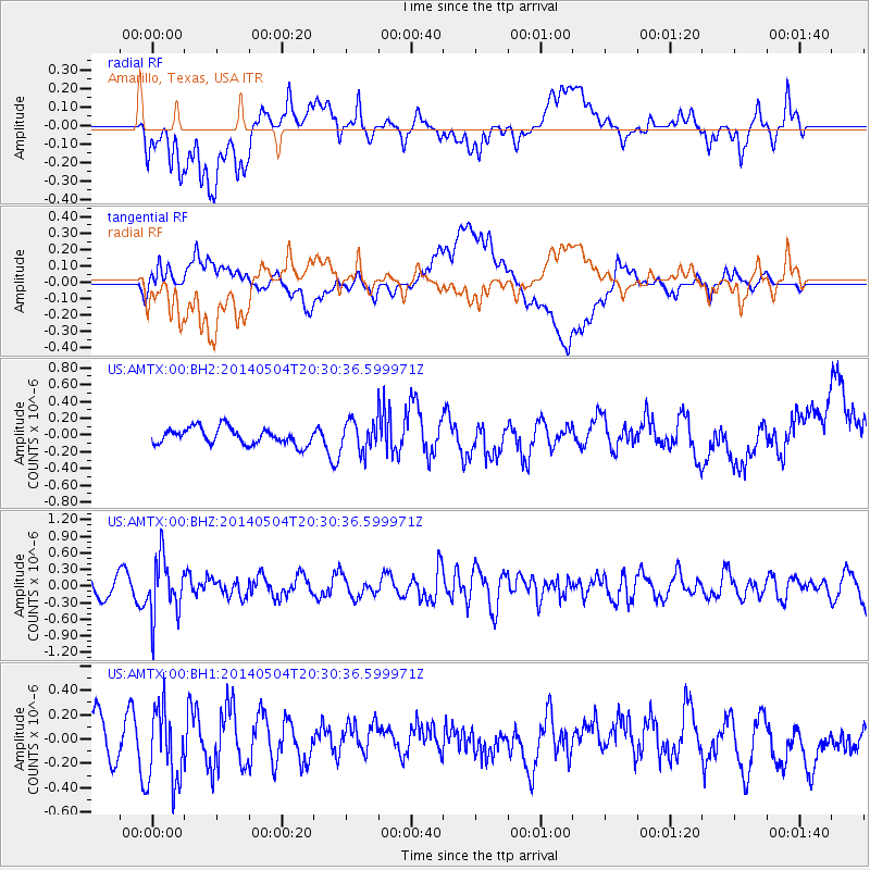
AMTX Amarillo, Texas, USA - Earthquake Result Viewer
*The percent match for this event was below the threshold and hence no stack was calculated.
| Earthquake location: |
Near S. Coast Of Honshu, Japan |
| Earthquake latitude/longitude: |
34.9/139.3 |
| Earthquake time(UTC): |
2014/05/04 (124) 20:18:25 GMT |
| Earthquake Depth: |
156 km |
| Earthquake Magnitude: |
5.8 MB |
| Earthquake Catalog/Contributor: |
NEIC PDE/NEIC COMCAT |
|
| Network: |
US United States National Seismic Network |
| Station: |
AMTX Amarillo, Texas, USA |
| Lat/Lon: |
34.53 N/101.41 W |
| Elevation: |
1010 m |
|
| Distance: |
90.6 deg |
| Az: |
46.071 deg |
| Baz: |
314.188 deg |
| Ray Param: |
$rayparam |
*The percent match for this event was below the threshold and hence was not used in the summary stack. |
|
| Radial Match: |
53.551178 % |
| Radial Bump: |
400 |
| Transverse Match: |
53.93713 % |
| Transverse Bump: |
400 |
| SOD ConfigId: |
626651 |
| Insert Time: |
2014-05-18 21:14:51.251 +0000 |
| GWidth: |
2.5 |
| Max Bumps: |
400 |
| Tol: |
0.001 |
|
Signal To Noise
| Channel | StoN | STA | LTA |
| US:AMTX:00:BHZ:20140504T20:30:36.599971Z | 2.887449 | 5.2183856E-7 | 1.807265E-7 |
| US:AMTX:00:BH1:20140504T20:30:36.599971Z | 1.8690013 | 3.0880517E-7 | 1.6522469E-7 |
| US:AMTX:00:BH2:20140504T20:30:36.599971Z | 2.5194554 | 2.469157E-7 | 9.8003596E-8 |
| Arrivals |
| Ps | |
| PpPs | |
| PsPs/PpSs | |


