You are here: Home > Network List > II - Global Seismograph Network (GSN - IRIS/IDA) Stations List
> Station PFO Pinon Flat, California, USA > Earthquake Result Viewer
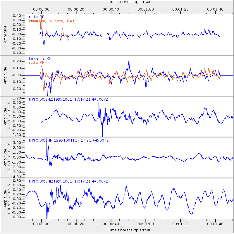
PFO Pinon Flat, California, USA - Earthquake Result Viewer
*The percent match for this event was below the threshold and hence no stack was calculated.
| Earthquake location: |
Southeast Of Honshu, Japan |
| Earthquake latitude/longitude: |
29.3/139.0 |
| Earthquake time(UTC): |
1995/10/01 (274) 17:06:03 GMT |
| Earthquake Depth: |
427 km |
| Earthquake Magnitude: |
5.5 MB, 5.8 UNKNOWN, 6.1 MW |
| Earthquake Catalog/Contributor: |
WHDF/NEIC |
|
| Network: |
II Global Seismograph Network (GSN - IRIS/IDA) |
| Station: |
PFO Pinon Flat, California, USA |
| Lat/Lon: |
33.61 N/116.46 W |
| Elevation: |
1280 m |
|
| Distance: |
85.1 deg |
| Az: |
54.149 deg |
| Baz: |
301.98 deg |
| Ray Param: |
$rayparam |
*The percent match for this event was below the threshold and hence was not used in the summary stack. |
|
| Radial Match: |
49.557842 % |
| Radial Bump: |
339 |
| Transverse Match: |
71.999725 % |
| Transverse Bump: |
400 |
| SOD ConfigId: |
4480 |
| Insert Time: |
2010-03-01 21:48:27.223 +0000 |
| GWidth: |
2.5 |
| Max Bumps: |
400 |
| Tol: |
0.001 |
|
Signal To Noise
| Channel | StoN | STA | LTA |
| II:PFO:00:BHN:19951001T17:17:21.445007Z | 3.2199595 | 1.065621E-6 | 3.3094236E-7 |
| II:PFO:00:BHE:19951001T17:17:21.445007Z | 1.1691399 | 3.8647156E-7 | 3.305606E-7 |
| II:PFO:00:BHZ:19951001T17:17:21.445007Z | 1.4363497 | 2.8758512E-7 | 2.0021942E-7 |
| Arrivals |
| Ps | |
| PpPs | |
| PsPs/PpSs | |


