You are here: Home > Network List > UW - Pacific Northwest Regional Seismic Network Stations List
> Station MRBL Marblemount, WA, USA > Earthquake Result Viewer
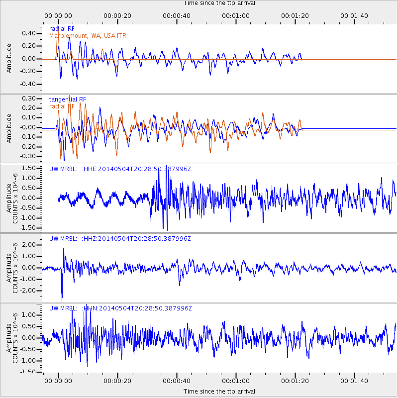
MRBL Marblemount, WA, USA - Earthquake Result Viewer
*The percent match for this event was below the threshold and hence no stack was calculated.
| Earthquake location: |
Near S. Coast Of Honshu, Japan |
| Earthquake latitude/longitude: |
34.9/139.3 |
| Earthquake time(UTC): |
2014/05/04 (124) 20:18:25 GMT |
| Earthquake Depth: |
156 km |
| Earthquake Magnitude: |
5.8 MB |
| Earthquake Catalog/Contributor: |
NEIC PDE/NEIC COMCAT |
|
| Network: |
UW Pacific Northwest Regional Seismic Network |
| Station: |
MRBL Marblemount, WA, USA |
| Lat/Lon: |
48.52 N/121.48 W |
| Elevation: |
75 m |
|
| Distance: |
70.2 deg |
| Az: |
44.217 deg |
| Baz: |
300.438 deg |
| Ray Param: |
$rayparam |
*The percent match for this event was below the threshold and hence was not used in the summary stack. |
|
| Radial Match: |
69.47325 % |
| Radial Bump: |
400 |
| Transverse Match: |
55.609703 % |
| Transverse Bump: |
400 |
| SOD ConfigId: |
626651 |
| Insert Time: |
2014-05-18 21:19:25.752 +0000 |
| GWidth: |
2.5 |
| Max Bumps: |
400 |
| Tol: |
0.001 |
|
Signal To Noise
| Channel | StoN | STA | LTA |
| UW:MRBL: :HHZ:20140504T20:28:50.387996Z | 2.652124 | 7.0059696E-7 | 2.641645E-7 |
| UW:MRBL: :HHN:20140504T20:28:50.387996Z | 1.4468205 | 4.0720334E-7 | 2.8144706E-7 |
| UW:MRBL: :HHE:20140504T20:28:50.387996Z | 2.1824765 | 4.7398626E-7 | 2.1717818E-7 |
| Arrivals |
| Ps | |
| PpPs | |
| PsPs/PpSs | |


