You are here: Home > Network List > CI - Caltech Regional Seismic Network Stations List
> Station MPM Manuel Prospect Mine, California, USA > Earthquake Result Viewer
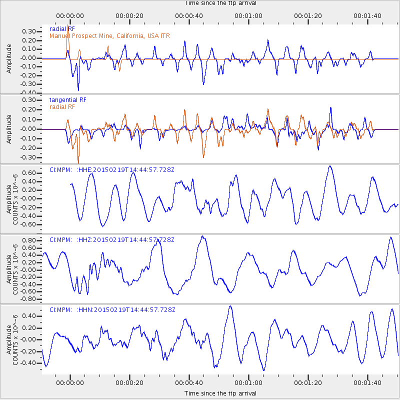
MPM Manuel Prospect Mine, California, USA - Earthquake Result Viewer
*The percent match for this event was below the threshold and hence no stack was calculated.
| Earthquake location: |
Vanuatu Islands |
| Earthquake latitude/longitude: |
-16.5/168.0 |
| Earthquake time(UTC): |
2015/02/19 (050) 14:32:41 GMT |
| Earthquake Depth: |
10 km |
| Earthquake Magnitude: |
5.5 MB |
| Earthquake Catalog/Contributor: |
NEIC PDE/NEIC COMCAT |
|
| Network: |
CI Caltech Regional Seismic Network |
| Station: |
MPM Manuel Prospect Mine, California, USA |
| Lat/Lon: |
36.06 N/117.49 W |
| Elevation: |
185 m |
|
| Distance: |
87.6 deg |
| Az: |
51.397 deg |
| Baz: |
247.679 deg |
| Ray Param: |
$rayparam |
*The percent match for this event was below the threshold and hence was not used in the summary stack. |
|
| Radial Match: |
68.12334 % |
| Radial Bump: |
400 |
| Transverse Match: |
42.64948 % |
| Transverse Bump: |
400 |
| SOD ConfigId: |
7019011 |
| Insert Time: |
2019-04-16 23:04:10.349 +0000 |
| GWidth: |
2.5 |
| Max Bumps: |
400 |
| Tol: |
0.001 |
|
Signal To Noise
| Channel | StoN | STA | LTA |
| CI:MPM: :HHZ:20150219T14:44:57.728Z | 1.1045008 | 3.7917727E-7 | 3.4330196E-7 |
| CI:MPM: :HHN:20150219T14:44:57.728Z | 0.67257327 | 1.8385076E-7 | 2.7335426E-7 |
| CI:MPM: :HHE:20150219T14:44:57.728Z | 0.56236374 | 2.0961892E-7 | 3.7274617E-7 |
| Arrivals |
| Ps | |
| PpPs | |
| PsPs/PpSs | |


