You are here: Home > Network List > II - Global Seismograph Network (GSN - IRIS/IDA) Stations List
> Station PFO Pinon Flat, California, USA > Earthquake Result Viewer
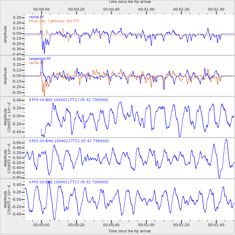
PFO Pinon Flat, California, USA - Earthquake Result Viewer
*The percent match for this event was below the threshold and hence no stack was calculated.
| Earthquake location: |
D'Entrecasteaux Islands Region |
| Earthquake latitude/longitude: |
-9.5/152.1 |
| Earthquake time(UTC): |
1994/02/17 (048) 21:52:47 GMT |
| Earthquake Depth: |
25 km |
| Earthquake Magnitude: |
5.8 MS, 5.2 MB |
| Earthquake Catalog/Contributor: |
WHDF/NEIC |
|
| Network: |
II Global Seismograph Network (GSN - IRIS/IDA) |
| Station: |
PFO Pinon Flat, California, USA |
| Lat/Lon: |
33.61 N/116.46 W |
| Elevation: |
1280 m |
|
| Distance: |
96.4 deg |
| Az: |
57.087 deg |
| Baz: |
262.914 deg |
| Ray Param: |
$rayparam |
*The percent match for this event was below the threshold and hence was not used in the summary stack. |
|
| Radial Match: |
63.003918 % |
| Radial Bump: |
400 |
| Transverse Match: |
60.06759 % |
| Transverse Bump: |
374 |
| SOD ConfigId: |
4480 |
| Insert Time: |
2010-03-01 21:48:41.281 +0000 |
| GWidth: |
2.5 |
| Max Bumps: |
400 |
| Tol: |
0.001 |
|
Signal To Noise
| Channel | StoN | STA | LTA |
| II:PFO:00:BHN:19940217T22:05:42.798999Z | 0.68422717 | 3.272437E-7 | 4.782676E-7 |
| II:PFO:00:BHE:19940217T22:05:42.798999Z | 1.0348966 | 2.9433036E-7 | 2.844056E-7 |
| II:PFO:00:BHZ:19940217T22:05:42.798999Z | 0.7503019 | 1.5531134E-7 | 2.0699846E-7 |
| Arrivals |
| Ps | |
| PpPs | |
| PsPs/PpSs | |


