You are here: Home > Network List > TA - USArray Transportable Network (new EarthScope stations) Stations List
> Station R11A Troy Canyon, Currant, NV, USA > Earthquake Result Viewer
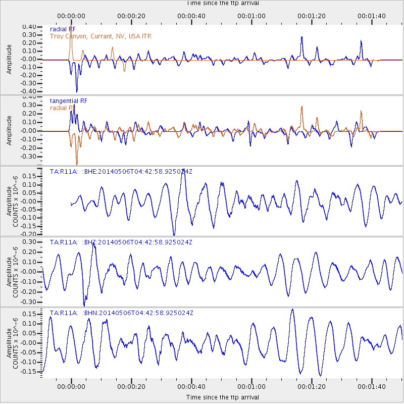
R11A Troy Canyon, Currant, NV, USA - Earthquake Result Viewer
*The percent match for this event was below the threshold and hence no stack was calculated.
| Earthquake location: |
Fiji Islands Region |
| Earthquake latitude/longitude: |
-20.1/-177.7 |
| Earthquake time(UTC): |
2014/05/06 (126) 04:32:06 GMT |
| Earthquake Depth: |
552 km |
| Earthquake Magnitude: |
5.7 MB |
| Earthquake Catalog/Contributor: |
NEIC PDE/NEIC COMCAT |
|
| Network: |
TA USArray Transportable Network (new EarthScope stations) |
| Station: |
R11A Troy Canyon, Currant, NV, USA |
| Lat/Lon: |
38.35 N/115.59 W |
| Elevation: |
1756 m |
|
| Distance: |
82.2 deg |
| Az: |
44.516 deg |
| Baz: |
236.94 deg |
| Ray Param: |
$rayparam |
*The percent match for this event was below the threshold and hence was not used in the summary stack. |
|
| Radial Match: |
56.268265 % |
| Radial Bump: |
400 |
| Transverse Match: |
55.843708 % |
| Transverse Bump: |
400 |
| SOD ConfigId: |
626651 |
| Insert Time: |
2014-05-20 05:08:48.352 +0000 |
| GWidth: |
2.5 |
| Max Bumps: |
400 |
| Tol: |
0.001 |
|
Signal To Noise
| Channel | StoN | STA | LTA |
| TA:R11A: :BHZ:20140506T04:42:58.925024Z | 1.8829651 | 1.5024165E-7 | 7.978993E-8 |
| TA:R11A: :BHN:20140506T04:42:58.925024Z | 0.81870407 | 6.725815E-8 | 8.215196E-8 |
| TA:R11A: :BHE:20140506T04:42:58.925024Z | 2.3648026 | 1.02449974E-7 | 4.3322842E-8 |
| Arrivals |
| Ps | |
| PpPs | |
| PsPs/PpSs | |


