You are here: Home > Network List > II - Global Seismograph Network (GSN - IRIS/IDA) Stations List
> Station PFO Pinon Flat, California, USA > Earthquake Result Viewer
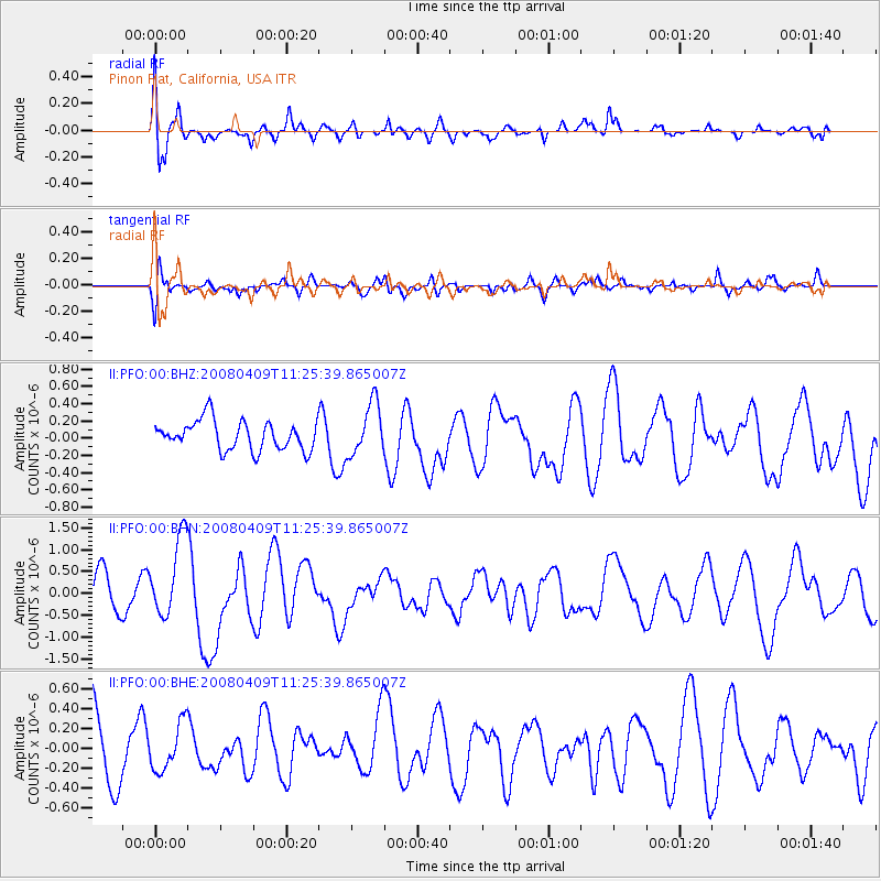
PFO Pinon Flat, California, USA - Earthquake Result Viewer
*The percent match for this event was below the threshold and hence no stack was calculated.
| Earthquake location: |
Loyalty Islands |
| Earthquake latitude/longitude: |
-20.2/168.9 |
| Earthquake time(UTC): |
2008/04/09 (100) 11:13:17 GMT |
| Earthquake Depth: |
13 km |
| Earthquake Magnitude: |
5.6 MB, 6.3 MS, 6.4 MW, 6.3 MW |
| Earthquake Catalog/Contributor: |
WHDF/NEIC |
|
| Network: |
II Global Seismograph Network (GSN - IRIS/IDA) |
| Station: |
PFO Pinon Flat, California, USA |
| Lat/Lon: |
33.61 N/116.46 W |
| Elevation: |
1280 m |
|
| Distance: |
89.0 deg |
| Az: |
53.612 deg |
| Baz: |
244.982 deg |
| Ray Param: |
$rayparam |
*The percent match for this event was below the threshold and hence was not used in the summary stack. |
|
| Radial Match: |
70.11452 % |
| Radial Bump: |
400 |
| Transverse Match: |
51.478138 % |
| Transverse Bump: |
400 |
| SOD ConfigId: |
2504 |
| Insert Time: |
2010-03-01 21:49:28.696 +0000 |
| GWidth: |
2.5 |
| Max Bumps: |
400 |
| Tol: |
0.001 |
|
Signal To Noise
| Channel | StoN | STA | LTA |
| II:PFO:00:BHN:20080409T11:25:39.865007Z | 2.2383626 | 9.239772E-7 | 4.1279156E-7 |
| II:PFO:00:BHE:20080409T11:25:39.865007Z | 0.6259002 | 2.3805498E-7 | 3.8034014E-7 |
| II:PFO:00:BHZ:20080409T11:25:39.865007Z | 1.7748224 | 3.007431E-7 | 1.6944969E-7 |
| Arrivals |
| Ps | |
| PpPs | |
| PsPs/PpSs | |


