You are here: Home > Network List > TA - USArray Transportable Network (new EarthScope stations) Stations List
> Station H47A Mio, MI, USA > Earthquake Result Viewer
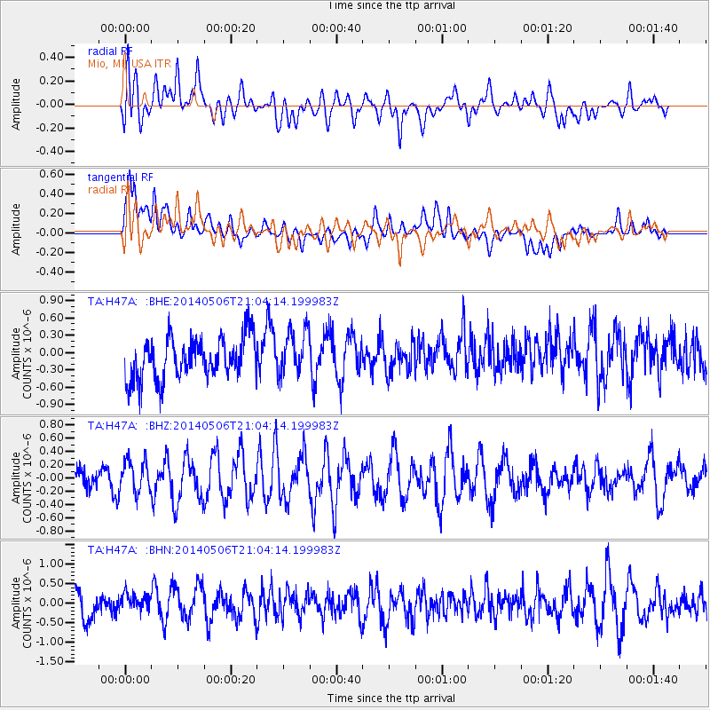
H47A Mio, MI, USA - Earthquake Result Viewer
*The percent match for this event was below the threshold and hence no stack was calculated.
| Earthquake location: |
West Chile Rise |
| Earthquake latitude/longitude: |
-36.3/-96.7 |
| Earthquake time(UTC): |
2014/05/06 (126) 20:52:29 GMT |
| Earthquake Depth: |
14 km |
| Earthquake Magnitude: |
5.9 MWB |
| Earthquake Catalog/Contributor: |
NEIC PDE/NEIC COMCAT |
|
| Network: |
TA USArray Transportable Network (new EarthScope stations) |
| Station: |
H47A Mio, MI, USA |
| Lat/Lon: |
44.60 N/84.21 W |
| Elevation: |
356 m |
|
| Distance: |
81.3 deg |
| Az: |
8.987 deg |
| Baz: |
190.174 deg |
| Ray Param: |
$rayparam |
*The percent match for this event was below the threshold and hence was not used in the summary stack. |
|
| Radial Match: |
64.56512 % |
| Radial Bump: |
400 |
| Transverse Match: |
51.83478 % |
| Transverse Bump: |
400 |
| SOD ConfigId: |
626651 |
| Insert Time: |
2014-05-20 21:19:39.356 +0000 |
| GWidth: |
2.5 |
| Max Bumps: |
400 |
| Tol: |
0.001 |
|
Signal To Noise
| Channel | StoN | STA | LTA |
| TA:H47A: :BHZ:20140506T21:04:14.199983Z | 0.96518177 | 2.390043E-7 | 2.476262E-7 |
| TA:H47A: :BHN:20140506T21:04:14.199983Z | 0.81993794 | 2.2118219E-7 | 2.6975482E-7 |
| TA:H47A: :BHE:20140506T21:04:14.199983Z | 1.0988181 | 3.9942216E-7 | 3.635016E-7 |
| Arrivals |
| Ps | |
| PpPs | |
| PsPs/PpSs | |


