You are here: Home > Network List > TA - USArray Transportable Network (new EarthScope stations) Stations List
> Station 833A Chaparral WMA, Artesia Wells, TX, USA > Earthquake Result Viewer
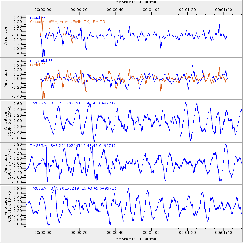
833A Chaparral WMA, Artesia Wells, TX, USA - Earthquake Result Viewer
*The percent match for this event was below the threshold and hence no stack was calculated.
| Earthquake location: |
Near East Coast Of Kamchatka |
| Earthquake latitude/longitude: |
52.8/159.0 |
| Earthquake time(UTC): |
2015/02/19 (050) 16:32:48 GMT |
| Earthquake Depth: |
88 km |
| Earthquake Magnitude: |
5.7 MB |
| Earthquake Catalog/Contributor: |
NEIC PDE/NEIC COMCAT |
|
| Network: |
TA USArray Transportable Network (new EarthScope stations) |
| Station: |
833A Chaparral WMA, Artesia Wells, TX, USA |
| Lat/Lon: |
28.32 N/99.39 W |
| Elevation: |
171 m |
|
| Distance: |
74.5 deg |
| Az: |
63.655 deg |
| Baz: |
321.935 deg |
| Ray Param: |
$rayparam |
*The percent match for this event was below the threshold and hence was not used in the summary stack. |
|
| Radial Match: |
62.345367 % |
| Radial Bump: |
400 |
| Transverse Match: |
47.01105 % |
| Transverse Bump: |
400 |
| SOD ConfigId: |
7019011 |
| Insert Time: |
2019-04-16 23:16:15.983 +0000 |
| GWidth: |
2.5 |
| Max Bumps: |
400 |
| Tol: |
0.001 |
|
Signal To Noise
| Channel | StoN | STA | LTA |
| TA:833A: :BHZ:20150219T16:43:45.649971Z | 1.172593 | 3.083074E-7 | 2.6292787E-7 |
| TA:833A: :BHN:20150219T16:43:45.649971Z | 2.6767156 | 5.211237E-7 | 1.9468774E-7 |
| TA:833A: :BHE:20150219T16:43:45.649971Z | 0.5840756 | 1.4856111E-7 | 2.5435253E-7 |
| Arrivals |
| Ps | |
| PpPs | |
| PsPs/PpSs | |


