You are here: Home > Network List > TA - USArray Transportable Network (new EarthScope stations) Stations List
> Station G59A Clarenceville, QC, USA > Earthquake Result Viewer
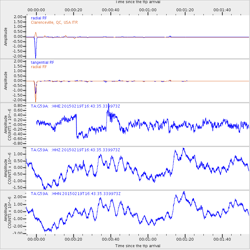
G59A Clarenceville, QC, USA - Earthquake Result Viewer
*The percent match for this event was below the threshold and hence no stack was calculated.
| Earthquake location: |
Near East Coast Of Kamchatka |
| Earthquake latitude/longitude: |
52.8/159.0 |
| Earthquake time(UTC): |
2015/02/19 (050) 16:32:48 GMT |
| Earthquake Depth: |
88 km |
| Earthquake Magnitude: |
5.7 MB |
| Earthquake Catalog/Contributor: |
NEIC PDE/NEIC COMCAT |
|
| Network: |
TA USArray Transportable Network (new EarthScope stations) |
| Station: |
G59A Clarenceville, QC, USA |
| Lat/Lon: |
45.08 N/73.18 W |
| Elevation: |
36 m |
|
| Distance: |
72.7 deg |
| Az: |
35.873 deg |
| Baz: |
329.888 deg |
| Ray Param: |
$rayparam |
*The percent match for this event was below the threshold and hence was not used in the summary stack. |
|
| Radial Match: |
99.48059 % |
| Radial Bump: |
58 |
| Transverse Match: |
98.13228 % |
| Transverse Bump: |
100 |
| SOD ConfigId: |
7019011 |
| Insert Time: |
2019-04-16 23:16:25.212 +0000 |
| GWidth: |
2.5 |
| Max Bumps: |
400 |
| Tol: |
0.001 |
|
Signal To Noise
| Channel | StoN | STA | LTA |
| TA:G59A: :HHZ:20150219T16:43:35.339973Z | 1.908487 | 2.5997233E-6 | 1.3621908E-6 |
| TA:G59A: :HHN:20150219T16:43:35.339973Z | 1.8932441 | 4.6105342E-6 | 2.4352562E-6 |
| TA:G59A: :HHE:20150219T16:43:35.339973Z | 0.9822363 | 2.3022098E-7 | 2.343845E-7 |
| Arrivals |
| Ps | |
| PpPs | |
| PsPs/PpSs | |


