You are here: Home > Network List > TA - USArray Transportable Network (new EarthScope stations) Stations List
> Station O03E Paynes Creek, CA, USA > Earthquake Result Viewer
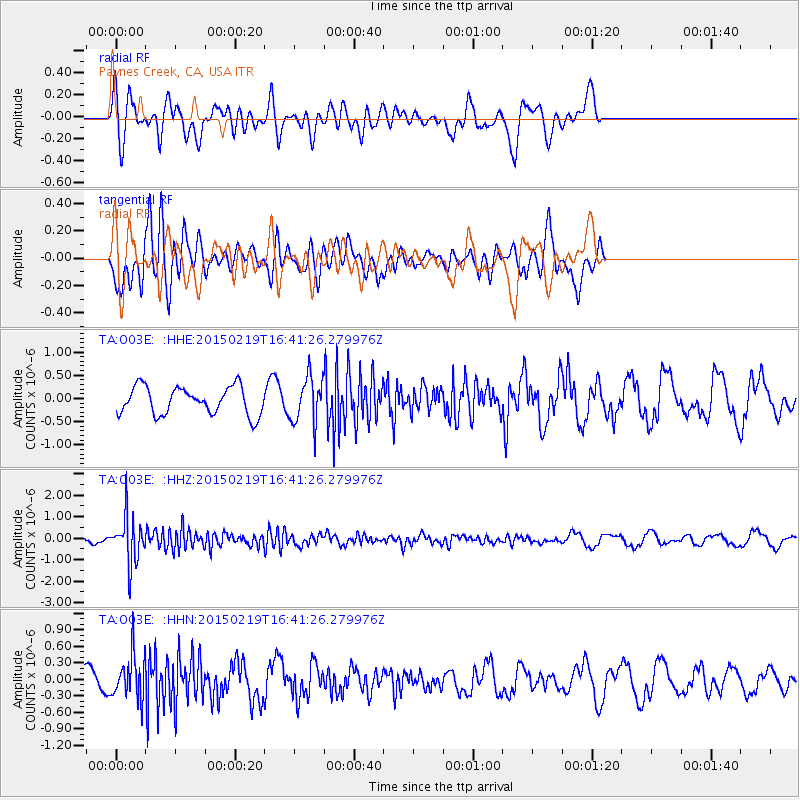
O03E Paynes Creek, CA, USA - Earthquake Result Viewer
*The percent match for this event was below the threshold and hence no stack was calculated.
| Earthquake location: |
Near East Coast Of Kamchatka |
| Earthquake latitude/longitude: |
52.8/159.0 |
| Earthquake time(UTC): |
2015/02/19 (050) 16:32:48 GMT |
| Earthquake Depth: |
88 km |
| Earthquake Magnitude: |
5.7 MB |
| Earthquake Catalog/Contributor: |
NEIC PDE/NEIC COMCAT |
|
| Network: |
TA USArray Transportable Network (new EarthScope stations) |
| Station: |
O03E Paynes Creek, CA, USA |
| Lat/Lon: |
40.29 N/121.80 W |
| Elevation: |
967 m |
|
| Distance: |
53.2 deg |
| Az: |
69.76 deg |
| Baz: |
311.921 deg |
| Ray Param: |
$rayparam |
*The percent match for this event was below the threshold and hence was not used in the summary stack. |
|
| Radial Match: |
72.44108 % |
| Radial Bump: |
400 |
| Transverse Match: |
56.762844 % |
| Transverse Bump: |
400 |
| SOD ConfigId: |
7019011 |
| Insert Time: |
2019-04-16 23:16:53.182 +0000 |
| GWidth: |
2.5 |
| Max Bumps: |
400 |
| Tol: |
0.001 |
|
Signal To Noise
| Channel | StoN | STA | LTA |
| TA:O03E: :HHZ:20150219T16:41:26.279976Z | 6.2634277 | 1.0825372E-6 | 1.7283463E-7 |
| TA:O03E: :HHN:20150219T16:41:26.279976Z | 2.157661 | 4.035985E-7 | 1.870537E-7 |
| TA:O03E: :HHE:20150219T16:41:26.279976Z | 1.816761 | 5.3988737E-7 | 2.9717026E-7 |
| Arrivals |
| Ps | |
| PpPs | |
| PsPs/PpSs | |


