You are here: Home > Network List > TA - USArray Transportable Network (new EarthScope stations) Stations List
> Station U57A Blanch, NC, USA > Earthquake Result Viewer
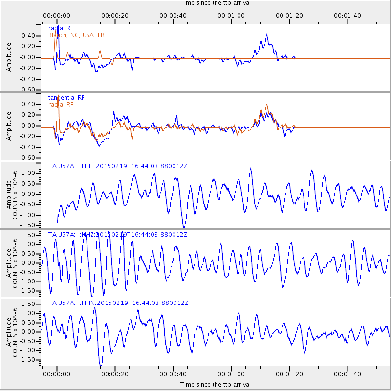
U57A Blanch, NC, USA - Earthquake Result Viewer
*The percent match for this event was below the threshold and hence no stack was calculated.
| Earthquake location: |
Near East Coast Of Kamchatka |
| Earthquake latitude/longitude: |
52.8/159.0 |
| Earthquake time(UTC): |
2015/02/19 (050) 16:32:48 GMT |
| Earthquake Depth: |
88 km |
| Earthquake Magnitude: |
5.7 MB |
| Earthquake Catalog/Contributor: |
NEIC PDE/NEIC COMCAT |
|
| Network: |
TA USArray Transportable Network (new EarthScope stations) |
| Station: |
U57A Blanch, NC, USA |
| Lat/Lon: |
36.43 N/79.34 W |
| Elevation: |
178 m |
|
| Distance: |
77.7 deg |
| Az: |
44.617 deg |
| Baz: |
328.112 deg |
| Ray Param: |
$rayparam |
*The percent match for this event was below the threshold and hence was not used in the summary stack. |
|
| Radial Match: |
56.33861 % |
| Radial Bump: |
400 |
| Transverse Match: |
36.42668 % |
| Transverse Bump: |
400 |
| SOD ConfigId: |
7019011 |
| Insert Time: |
2019-04-16 23:17:04.661 +0000 |
| GWidth: |
2.5 |
| Max Bumps: |
400 |
| Tol: |
0.001 |
|
Signal To Noise
| Channel | StoN | STA | LTA |
| TA:U57A: :HHZ:20150219T16:44:03.880012Z | 1.1669761 | 6.963009E-7 | 5.966711E-7 |
| TA:U57A: :HHN:20150219T16:44:03.880012Z | 1.2313179 | 8.9811596E-7 | 7.2939406E-7 |
| TA:U57A: :HHE:20150219T16:44:03.880012Z | 1.6319683 | 6.3598543E-7 | 3.8970455E-7 |
| Arrivals |
| Ps | |
| PpPs | |
| PsPs/PpSs | |


