You are here: Home > Network List > TA - USArray Transportable Network (new EarthScope stations) Stations List
> Station O03E Paynes Creek, CA, USA > Earthquake Result Viewer
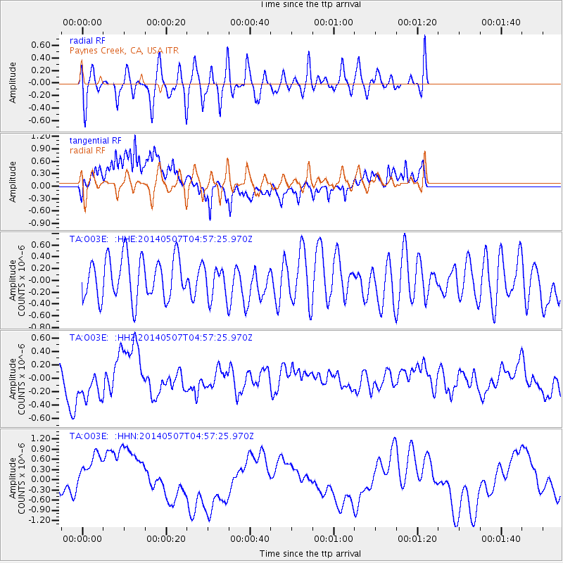
O03E Paynes Creek, CA, USA - Earthquake Result Viewer
*The percent match for this event was below the threshold and hence no stack was calculated.
| Earthquake location: |
Solomon Islands |
| Earthquake latitude/longitude: |
-7.0/154.8 |
| Earthquake time(UTC): |
2014/05/07 (127) 04:45:00 GMT |
| Earthquake Depth: |
10 km |
| Earthquake Magnitude: |
5.6 MB |
| Earthquake Catalog/Contributor: |
NEIC PDE/NEIC COMCAT |
|
| Network: |
TA USArray Transportable Network (new EarthScope stations) |
| Station: |
O03E Paynes Creek, CA, USA |
| Lat/Lon: |
40.29 N/121.80 W |
| Elevation: |
967 m |
|
| Distance: |
89.5 deg |
| Az: |
49.446 deg |
| Baz: |
260.418 deg |
| Ray Param: |
$rayparam |
*The percent match for this event was below the threshold and hence was not used in the summary stack. |
|
| Radial Match: |
59.806343 % |
| Radial Bump: |
357 |
| Transverse Match: |
74.95174 % |
| Transverse Bump: |
400 |
| SOD ConfigId: |
626651 |
| Insert Time: |
2014-05-21 05:12:22.707 +0000 |
| GWidth: |
2.5 |
| Max Bumps: |
400 |
| Tol: |
0.001 |
|
Signal To Noise
| Channel | StoN | STA | LTA |
| TA:O03E: :HHZ:20140507T04:57:25.970Z | 1.8412174 | 2.611504E-7 | 1.4183573E-7 |
| TA:O03E: :HHN:20140507T04:57:25.970Z | 2.1007688 | 7.6204657E-7 | 3.627465E-7 |
| TA:O03E: :HHE:20140507T04:57:25.970Z | 0.7933669 | 2.7877937E-7 | 3.513877E-7 |
| Arrivals |
| Ps | |
| PpPs | |
| PsPs/PpSs | |


