You are here: Home > Network List > II - Global Seismograph Network (GSN - IRIS/IDA) Stations List
> Station PFO Pinon Flat, California, USA > Earthquake Result Viewer
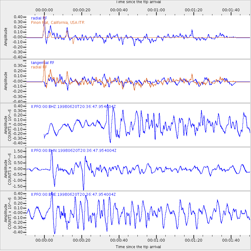
PFO Pinon Flat, California, USA - Earthquake Result Viewer
*The percent match for this event was below the threshold and hence no stack was calculated.
| Earthquake location: |
Kermadec Islands, New Zealand |
| Earthquake latitude/longitude: |
-30.1/-177.9 |
| Earthquake time(UTC): |
1998/06/20 (171) 20:24:45 GMT |
| Earthquake Depth: |
57 km |
| Earthquake Magnitude: |
5.7 MB, 6.0 UNKNOWN, 6.0 MW |
| Earthquake Catalog/Contributor: |
WHDF/NEIC |
|
| Network: |
II Global Seismograph Network (GSN - IRIS/IDA) |
| Station: |
PFO Pinon Flat, California, USA |
| Lat/Lon: |
33.61 N/116.46 W |
| Elevation: |
1280 m |
|
| Distance: |
86.0 deg |
| Az: |
47.309 deg |
| Baz: |
229.75 deg |
| Ray Param: |
$rayparam |
*The percent match for this event was below the threshold and hence was not used in the summary stack. |
|
| Radial Match: |
75.84733 % |
| Radial Bump: |
400 |
| Transverse Match: |
79.68853 % |
| Transverse Bump: |
400 |
| SOD ConfigId: |
4480 |
| Insert Time: |
2010-03-01 21:50:41.427 +0000 |
| GWidth: |
2.5 |
| Max Bumps: |
400 |
| Tol: |
0.001 |
|
Signal To Noise
| Channel | StoN | STA | LTA |
| II:PFO:00:BHN:19980620T20:36:47.954004Z | 4.7407737 | 5.6710894E-7 | 1.196237E-7 |
| II:PFO:00:BHE:19980620T20:36:47.954004Z | 1.6659809 | 1.8012172E-7 | 1.0811752E-7 |
| II:PFO:00:BHZ:19980620T20:36:47.954004Z | 1.9870412 | 1.8900377E-7 | 9.5118196E-8 |
| Arrivals |
| Ps | |
| PpPs | |
| PsPs/PpSs | |


