You are here: Home > Network List > AZ - ANZA Regional Network Stations List
> Station SMER AZ.SMER > Earthquake Result Viewer
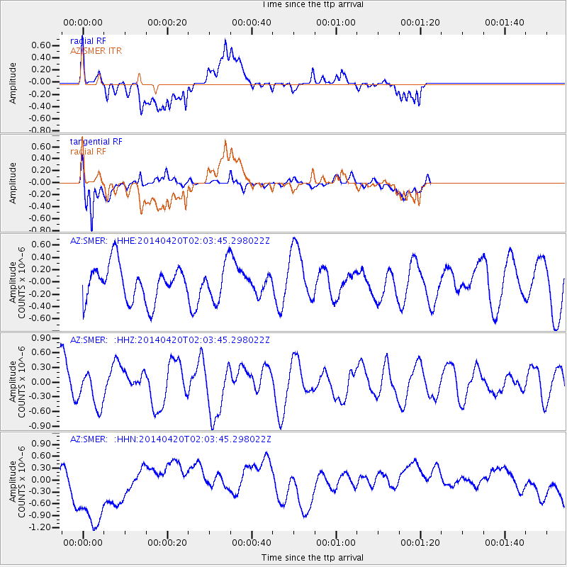
SMER AZ.SMER - Earthquake Result Viewer
*The percent match for this event was below the threshold and hence no stack was calculated.
| Earthquake location: |
Southern East Pacific Rise |
| Earthquake latitude/longitude: |
-26.6/-115.0 |
| Earthquake time(UTC): |
2014/04/20 (110) 01:54:11 GMT |
| Earthquake Depth: |
10 km |
| Earthquake Magnitude: |
5.9 MWC, 5.9 MWC |
| Earthquake Catalog/Contributor: |
NEIC PDE/NEIC COMCAT |
|
| Network: |
AZ ANZA Regional Network |
| Station: |
SMER AZ.SMER |
| Lat/Lon: |
33.46 N/117.17 W |
| Elevation: |
355 m |
|
| Distance: |
59.7 deg |
| Az: |
357.92 deg |
| Baz: |
177.771 deg |
| Ray Param: |
$rayparam |
*The percent match for this event was below the threshold and hence was not used in the summary stack. |
|
| Radial Match: |
41.738346 % |
| Radial Bump: |
400 |
| Transverse Match: |
78.64299 % |
| Transverse Bump: |
400 |
| SOD ConfigId: |
626651 |
| Insert Time: |
2014-05-22 00:04:18.991 +0000 |
| GWidth: |
2.5 |
| Max Bumps: |
400 |
| Tol: |
0.001 |
|
Signal To Noise
| Channel | StoN | STA | LTA |
| AZ:SMER: :HHZ:20140420T02:03:45.298022Z | 1.2117656 | 3.7392306E-7 | 3.0857706E-7 |
| AZ:SMER: :HHN:20140420T02:03:45.298022Z | 3.041042 | 1.1463617E-6 | 3.7696344E-7 |
| AZ:SMER: :HHE:20140420T02:03:45.298022Z | 1.06468 | 3.091901E-7 | 2.904066E-7 |
| Arrivals |
| Ps | |
| PpPs | |
| PsPs/PpSs | |


