You are here: Home > Network List > II - Global Seismograph Network (GSN - IRIS/IDA) Stations List
> Station PFO Pinon Flat, California, USA > Earthquake Result Viewer
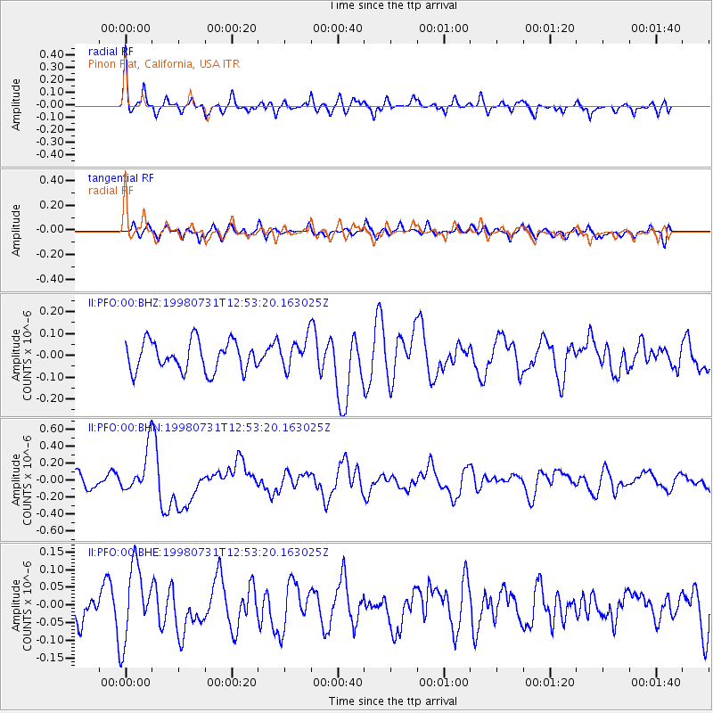
PFO Pinon Flat, California, USA - Earthquake Result Viewer
*The percent match for this event was below the threshold and hence no stack was calculated.
| Earthquake location: |
Southeast Of Loyalty Islands |
| Earthquake latitude/longitude: |
-21.6/169.8 |
| Earthquake time(UTC): |
1998/07/31 (212) 12:40:59 GMT |
| Earthquake Depth: |
33 km |
| Earthquake Magnitude: |
5.9 MS, 5.4 MB, 6.1 UNKNOWN, 6.0 MW |
| Earthquake Catalog/Contributor: |
WHDF/NEIC |
|
| Network: |
II Global Seismograph Network (GSN - IRIS/IDA) |
| Station: |
PFO Pinon Flat, California, USA |
| Lat/Lon: |
33.61 N/116.46 W |
| Elevation: |
1280 m |
|
| Distance: |
89.1 deg |
| Az: |
53.245 deg |
| Baz: |
243.298 deg |
| Ray Param: |
$rayparam |
*The percent match for this event was below the threshold and hence was not used in the summary stack. |
|
| Radial Match: |
61.687256 % |
| Radial Bump: |
400 |
| Transverse Match: |
38.87099 % |
| Transverse Bump: |
400 |
| SOD ConfigId: |
4480 |
| Insert Time: |
2010-03-01 21:50:49.921 +0000 |
| GWidth: |
2.5 |
| Max Bumps: |
400 |
| Tol: |
0.001 |
|
Signal To Noise
| Channel | StoN | STA | LTA |
| II:PFO:00:BHN:19980731T12:53:20.163025Z | 4.162922 | 2.7068273E-7 | 6.50223E-8 |
| II:PFO:00:BHE:19980731T12:53:20.163025Z | 2.0876398 | 1.01517934E-7 | 4.8628088E-8 |
| II:PFO:00:BHZ:19980731T12:53:20.163025Z | 1.0292289 | 6.943117E-8 | 6.74594E-8 |
| Arrivals |
| Ps | |
| PpPs | |
| PsPs/PpSs | |


