You are here: Home > Network List > TA - USArray Transportable Network (new EarthScope stations) Stations List
> Station 435B Jarrell, TX, USA > Earthquake Result Viewer
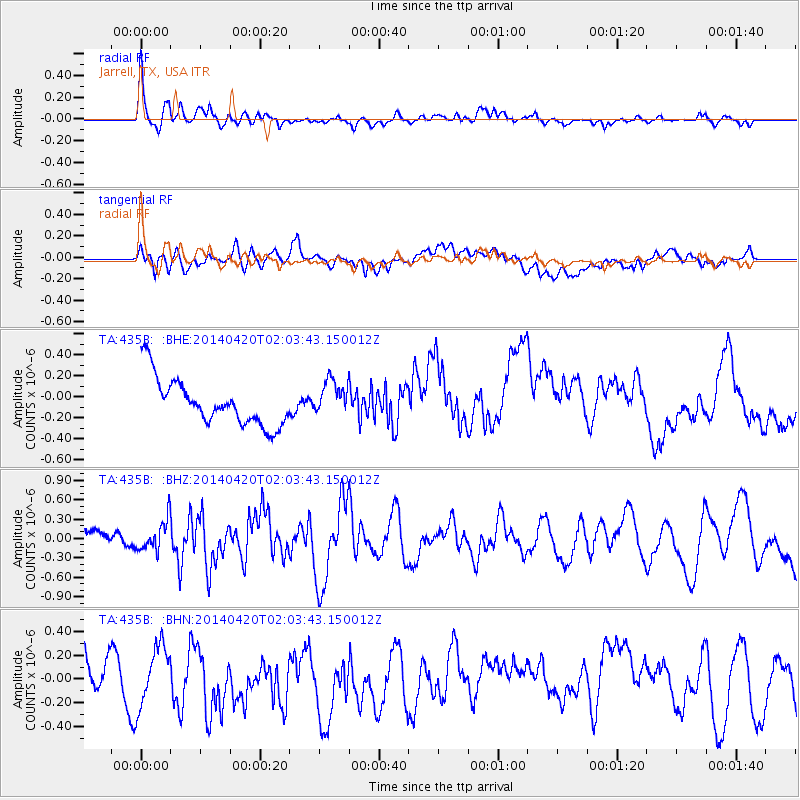
435B Jarrell, TX, USA - Earthquake Result Viewer
*The percent match for this event was below the threshold and hence no stack was calculated.
| Earthquake location: |
Southern East Pacific Rise |
| Earthquake latitude/longitude: |
-26.6/-115.0 |
| Earthquake time(UTC): |
2014/04/20 (110) 01:54:11 GMT |
| Earthquake Depth: |
10 km |
| Earthquake Magnitude: |
5.9 MWC, 5.9 MWC |
| Earthquake Catalog/Contributor: |
NEIC PDE/NEIC COMCAT |
|
| Network: |
TA USArray Transportable Network (new EarthScope stations) |
| Station: |
435B Jarrell, TX, USA |
| Lat/Lon: |
30.78 N/97.58 W |
| Elevation: |
248 m |
|
| Distance: |
59.4 deg |
| Az: |
17.434 deg |
| Baz: |
198.169 deg |
| Ray Param: |
$rayparam |
*The percent match for this event was below the threshold and hence was not used in the summary stack. |
|
| Radial Match: |
71.99526 % |
| Radial Bump: |
400 |
| Transverse Match: |
40.09311 % |
| Transverse Bump: |
400 |
| SOD ConfigId: |
626651 |
| Insert Time: |
2014-05-22 00:27:54.557 +0000 |
| GWidth: |
2.5 |
| Max Bumps: |
400 |
| Tol: |
0.001 |
|
Signal To Noise
| Channel | StoN | STA | LTA |
| TA:435B: :BHZ:20140420T02:03:43.150012Z | 1.8690135 | 2.3574236E-7 | 1.2613198E-7 |
| TA:435B: :BHN:20140420T02:03:43.150012Z | 1.69597 | 2.4830692E-7 | 1.4640996E-7 |
| TA:435B: :BHE:20140420T02:03:43.150012Z | 0.76160324 | 1.6882835E-7 | 2.2167494E-7 |
| Arrivals |
| Ps | |
| PpPs | |
| PsPs/PpSs | |


