You are here: Home > Network List > II - Global Seismograph Network (GSN - IRIS/IDA) Stations List
> Station PFO Pinon Flat, California, USA > Earthquake Result Viewer
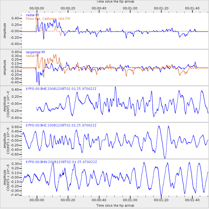
PFO Pinon Flat, California, USA - Earthquake Result Viewer
*The percent match for this event was below the threshold and hence no stack was calculated.
| Earthquake location: |
Northern Mid-Atlantic Ridge |
| Earthquake latitude/longitude: |
13.4/-44.8 |
| Earthquake time(UTC): |
2008/12/08 (343) 01:51:01 GMT |
| Earthquake Depth: |
10 km |
| Earthquake Magnitude: |
5.6 MB, 5.1 MS, 5.5 MW, 5.5 MW |
| Earthquake Catalog/Contributor: |
WHDF/NEIC |
|
| Network: |
II Global Seismograph Network (GSN - IRIS/IDA) |
| Station: |
PFO Pinon Flat, California, USA |
| Lat/Lon: |
33.61 N/116.46 W |
| Elevation: |
1280 m |
|
| Distance: |
67.5 deg |
| Az: |
300.98 deg |
| Baz: |
88.531 deg |
| Ray Param: |
$rayparam |
*The percent match for this event was below the threshold and hence was not used in the summary stack. |
|
| Radial Match: |
54.709064 % |
| Radial Bump: |
400 |
| Transverse Match: |
63.088177 % |
| Transverse Bump: |
400 |
| SOD ConfigId: |
2658 |
| Insert Time: |
2010-03-01 21:51:11.802 +0000 |
| GWidth: |
2.5 |
| Max Bumps: |
400 |
| Tol: |
0.001 |
|
Signal To Noise
| Channel | StoN | STA | LTA |
| II:PFO:00:BHZ:20081208T02:01:25.970022Z | 1.1526775 | 3.1536396E-7 | 2.7359255E-7 |
| II:PFO:00:BHN:20081208T02:01:25.970022Z | 0.308645 | 6.157923E-8 | 1.9951476E-7 |
| II:PFO:00:BHE:20081208T02:01:25.970022Z | 1.9056603 | 2.25627E-7 | 1.1839834E-7 |
| Arrivals |
| Ps | |
| PpPs | |
| PsPs/PpSs | |


