You are here: Home > Network List > II - Global Seismograph Network (GSN - IRIS/IDA) Stations List
> Station PFO Pinon Flat, California, USA > Earthquake Result Viewer
PFO Pinon Flat, California, USA - Earthquake Result Viewer
*The percent match for this event was below the threshold and hence no stack was calculated.
| Earthquake location: |
Fiji Islands Region |
| Earthquake latitude/longitude: |
-17.6/-178.6 |
| Earthquake time(UTC): |
2004/07/15 (197) 04:27:12 GMT |
| Earthquake Depth: |
560 km |
| Earthquake Magnitude: |
5.5 MB |
| Earthquake Catalog/Contributor: |
WHDF/NEIC |
|
| Network: |
II Global Seismograph Network (GSN - IRIS/IDA) |
| Station: |
PFO Pinon Flat, California, USA |
| Lat/Lon: |
33.61 N/116.46 W |
| Elevation: |
1280 m |
|
| Distance: |
78.1 deg |
| Az: |
48.946 deg |
| Baz: |
239.502 deg |
| Ray Param: |
$rayparam |
*The percent match for this event was below the threshold and hence was not used in the summary stack. |
|
| Radial Match: |
91.56579 % |
| Radial Bump: |
341 |
| Transverse Match: |
83.48913 % |
| Transverse Bump: |
400 |
| SOD ConfigId: |
2459 |
| Insert Time: |
2010-03-01 21:51:14.976 +0000 |
| GWidth: |
2.5 |
| Max Bumps: |
400 |
| Tol: |
0.001 |
|
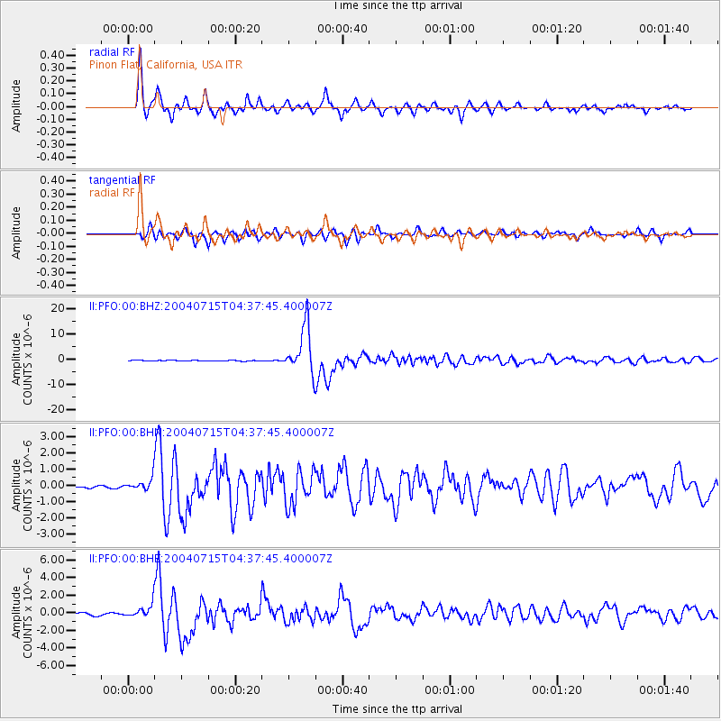
Signal To Noise
| Channel | StoN | STA | LTA |
| II:PFO:00:BHN:20040715T04:37:45.400007Z | 4.6229715 | 4.2654793E-7 | 9.2267044E-8 |
| II:PFO:00:BHE:20040715T04:37:45.400007Z | 6.002181 | 8.530461E-7 | 1.4212269E-7 |
| II:PFO:00:BHZ:20040715T04:37:45.400007Z | 17.710674 | 3.131266E-6 | 1.7680107E-7 |
| Arrivals |
| Ps | |
| PpPs | |
| PsPs/PpSs | |


