You are here: Home > Network List > II - Global Seismograph Network (GSN - IRIS/IDA) Stations List
> Station PFO Pinon Flat, California, USA > Earthquake Result Viewer
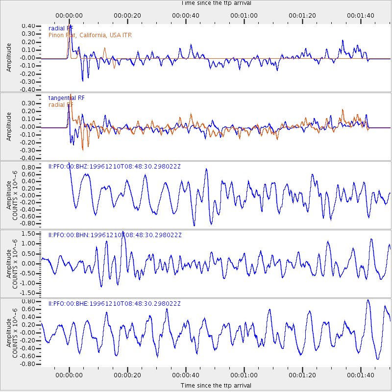
PFO Pinon Flat, California, USA - Earthquake Result Viewer
*The percent match for this event was below the threshold and hence no stack was calculated.
| Earthquake location: |
Central Mid-Atlantic Ridge |
| Earthquake latitude/longitude: |
0.9/-30.0 |
| Earthquake time(UTC): |
1996/12/10 (345) 08:36:18 GMT |
| Earthquake Depth: |
10 km |
| Earthquake Magnitude: |
6.0 MB, 6.2 MS, 6.6 UNKNOWN, 6.6 MW |
| Earthquake Catalog/Contributor: |
WHDF/NEIC |
|
| Network: |
II Global Seismograph Network (GSN - IRIS/IDA) |
| Station: |
PFO Pinon Flat, California, USA |
| Lat/Lon: |
33.61 N/116.46 W |
| Elevation: |
1280 m |
|
| Distance: |
86.5 deg |
| Az: |
303.443 deg |
| Baz: |
91.254 deg |
| Ray Param: |
$rayparam |
*The percent match for this event was below the threshold and hence was not used in the summary stack. |
|
| Radial Match: |
69.20306 % |
| Radial Bump: |
400 |
| Transverse Match: |
53.05445 % |
| Transverse Bump: |
400 |
| SOD ConfigId: |
4480 |
| Insert Time: |
2010-03-01 21:51:16.615 +0000 |
| GWidth: |
2.5 |
| Max Bumps: |
400 |
| Tol: |
0.001 |
|
Signal To Noise
| Channel | StoN | STA | LTA |
| II:PFO:00:BHN:19961210T08:48:30.298022Z | 0.6229123 | 1.6197626E-7 | 2.6003062E-7 |
| II:PFO:00:BHE:19961210T08:48:30.298022Z | 1.8969281 | 2.696889E-7 | 1.421714E-7 |
| II:PFO:00:BHZ:19961210T08:48:30.298022Z | 1.0248975 | 3.3470045E-7 | 3.265697E-7 |
| Arrivals |
| Ps | |
| PpPs | |
| PsPs/PpSs | |


