You are here: Home > Network List > II - Global Seismograph Network (GSN - IRIS/IDA) Stations List
> Station PFO Pinon Flat, California, USA > Earthquake Result Viewer
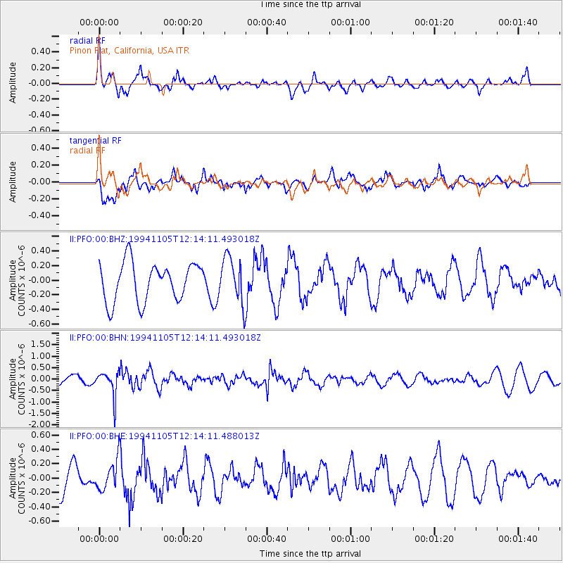
PFO Pinon Flat, California, USA - Earthquake Result Viewer
*The percent match for this event was below the threshold and hence no stack was calculated.
| Earthquake location: |
Peru-Brazil Border Region |
| Earthquake latitude/longitude: |
-9.3/-71.3 |
| Earthquake time(UTC): |
1994/11/05 (309) 12:05:28 GMT |
| Earthquake Depth: |
597 km |
| Earthquake Magnitude: |
5.6 MB, 5.8 UNKNOWN, 5.6 MW |
| Earthquake Catalog/Contributor: |
WHDF/NEIC |
|
| Network: |
II Global Seismograph Network (GSN - IRIS/IDA) |
| Station: |
PFO Pinon Flat, California, USA |
| Lat/Lon: |
33.61 N/116.46 W |
| Elevation: |
1280 m |
|
| Distance: |
60.5 deg |
| Az: |
317.184 deg |
| Baz: |
126.503 deg |
| Ray Param: |
$rayparam |
*The percent match for this event was below the threshold and hence was not used in the summary stack. |
|
| Radial Match: |
56.875195 % |
| Radial Bump: |
400 |
| Transverse Match: |
54.478848 % |
| Transverse Bump: |
400 |
| SOD ConfigId: |
4480 |
| Insert Time: |
2010-03-01 21:51:26.598 +0000 |
| GWidth: |
2.5 |
| Max Bumps: |
400 |
| Tol: |
0.001 |
|
Signal To Noise
| Channel | StoN | STA | LTA |
| II:PFO:00:BHN:19941105T12:14:11.493018Z | 2.817228 | 5.563132E-7 | 1.9746828E-7 |
| II:PFO:00:BHE:19941105T12:14:11.488013Z | 0.8626002 | 2.1658118E-7 | 2.5107946E-7 |
| II:PFO:00:BHZ:19941105T12:14:11.493018Z | 1.2128865 | 3.2114562E-7 | 2.6477795E-7 |
| Arrivals |
| Ps | |
| PpPs | |
| PsPs/PpSs | |


