You are here: Home > Network List > II - Global Seismograph Network (GSN - IRIS/IDA) Stations List
> Station PFO Pinon Flat, California, USA > Earthquake Result Viewer
PFO Pinon Flat, California, USA - Earthquake Result Viewer
*The percent match for this event was below the threshold and hence no stack was calculated.
| Earthquake location: |
Solomon Islands |
| Earthquake latitude/longitude: |
-9.8/159.7 |
| Earthquake time(UTC): |
1994/11/20 (324) 02:57:15 GMT |
| Earthquake Depth: |
24 km |
| Earthquake Magnitude: |
5.7 MB, 5.5 MS, 5.3 UNKNOWN, 5.8 MW |
| Earthquake Catalog/Contributor: |
WHDF/NEIC |
|
| Network: |
II Global Seismograph Network (GSN - IRIS/IDA) |
| Station: |
PFO Pinon Flat, California, USA |
| Lat/Lon: |
33.61 N/116.46 W |
| Elevation: |
1280 m |
|
| Distance: |
90.3 deg |
| Az: |
56.074 deg |
| Baz: |
258.534 deg |
| Ray Param: |
$rayparam |
*The percent match for this event was below the threshold and hence was not used in the summary stack. |
|
| Radial Match: |
78.007034 % |
| Radial Bump: |
400 |
| Transverse Match: |
84.50115 % |
| Transverse Bump: |
400 |
| SOD ConfigId: |
4480 |
| Insert Time: |
2010-03-01 21:51:33.774 +0000 |
| GWidth: |
2.5 |
| Max Bumps: |
400 |
| Tol: |
0.001 |
|
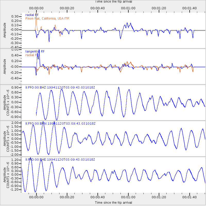
Signal To Noise
| Channel | StoN | STA | LTA |
| II:PFO:00:BHN:19941120T03:09:43.031018Z | 2.816484 | 1.4119552E-6 | 5.0131837E-7 |
| II:PFO:00:BHE:19941120T03:09:43.031018Z | 1.705162 | 9.3470726E-7 | 5.4816326E-7 |
| II:PFO:00:BHZ:19941120T03:09:43.031018Z | 0.75516474 | 4.548134E-7 | 6.0227046E-7 |
| Arrivals |
| Ps | |
| PpPs | |
| PsPs/PpSs | |


