You are here: Home > Network List > CU - Caribbean Network (USGS) Stations List
> Station BBGH Gun Hill, Barbados > Earthquake Result Viewer
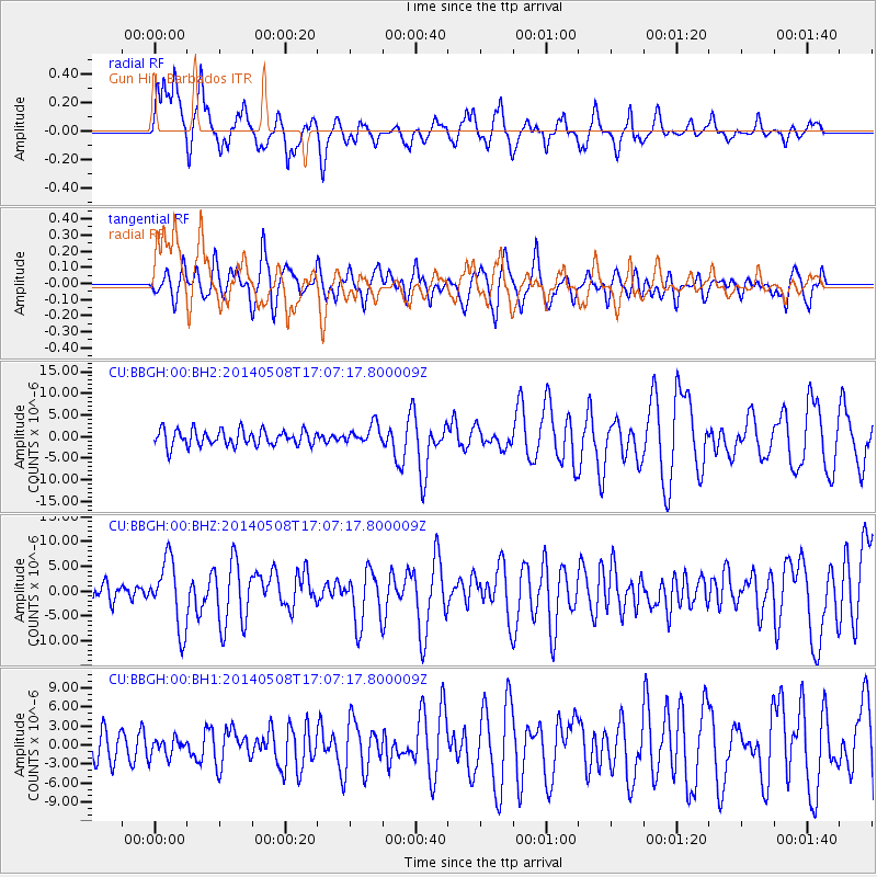
BBGH Gun Hill, Barbados - Earthquake Result Viewer
*The percent match for this event was below the threshold and hence no stack was calculated.
| Earthquake location: |
Guerrero, Mexico |
| Earthquake latitude/longitude: |
17.4/-100.7 |
| Earthquake time(UTC): |
2014/05/08 (128) 17:00:17 GMT |
| Earthquake Depth: |
24 km |
| Earthquake Magnitude: |
6.4 MWW, 6.8 MI |
| Earthquake Catalog/Contributor: |
NEIC PDE/NEIC COMCAT |
|
| Network: |
CU Caribbean Network (USGS) |
| Station: |
BBGH Gun Hill, Barbados |
| Lat/Lon: |
13.14 N/59.56 W |
| Elevation: |
180 m |
|
| Distance: |
39.8 deg |
| Az: |
90.201 deg |
| Baz: |
281.411 deg |
| Ray Param: |
$rayparam |
*The percent match for this event was below the threshold and hence was not used in the summary stack. |
|
| Radial Match: |
76.98307 % |
| Radial Bump: |
400 |
| Transverse Match: |
60.21701 % |
| Transverse Bump: |
400 |
| SOD ConfigId: |
626651 |
| Insert Time: |
2014-05-22 17:20:54.960 +0000 |
| GWidth: |
2.5 |
| Max Bumps: |
400 |
| Tol: |
0.001 |
|
Signal To Noise
| Channel | StoN | STA | LTA |
| CU:BBGH:00:BHZ:20140508T17:07:17.800009Z | 3.3663397 | 6.799575E-6 | 2.019872E-6 |
| CU:BBGH:00:BH1:20140508T17:07:17.800009Z | 0.7793566 | 1.4231856E-6 | 1.8261032E-6 |
| CU:BBGH:00:BH2:20140508T17:07:17.800009Z | 1.1847934 | 2.179679E-6 | 1.8397125E-6 |
| Arrivals |
| Ps | |
| PpPs | |
| PsPs/PpSs | |


