You are here: Home > Network List > TA - USArray Transportable Network (new EarthScope stations) Stations List
> Station G59A Clarenceville, QC, USA > Earthquake Result Viewer
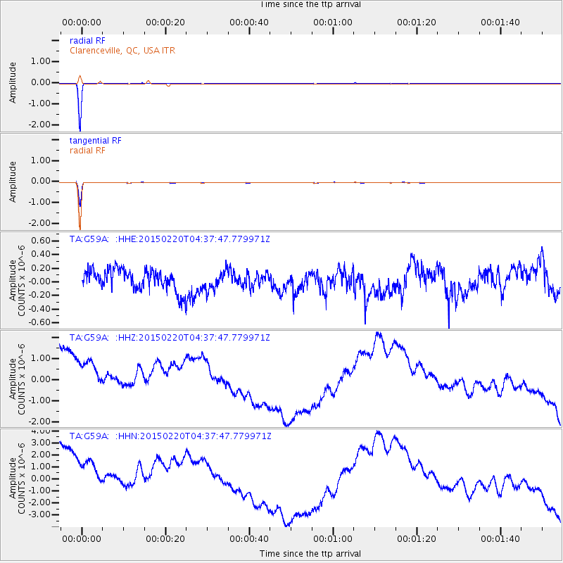
G59A Clarenceville, QC, USA - Earthquake Result Viewer
*The percent match for this event was below the threshold and hence no stack was calculated.
| Earthquake location: |
Off East Coast Of Honshu, Japan |
| Earthquake latitude/longitude: |
39.8/143.6 |
| Earthquake time(UTC): |
2015/02/20 (051) 04:25:24 GMT |
| Earthquake Depth: |
14 km |
| Earthquake Magnitude: |
6.3 MWP |
| Earthquake Catalog/Contributor: |
NEIC PDE/NEIC COMCAT |
|
| Network: |
TA USArray Transportable Network (new EarthScope stations) |
| Station: |
G59A Clarenceville, QC, USA |
| Lat/Lon: |
45.08 N/73.18 W |
| Elevation: |
36 m |
|
| Distance: |
89.2 deg |
| Az: |
25.084 deg |
| Baz: |
332.57 deg |
| Ray Param: |
$rayparam |
*The percent match for this event was below the threshold and hence was not used in the summary stack. |
|
| Radial Match: |
99.85341 % |
| Radial Bump: |
23 |
| Transverse Match: |
99.09811 % |
| Transverse Bump: |
52 |
| SOD ConfigId: |
7019011 |
| Insert Time: |
2019-04-16 23:28:30.614 +0000 |
| GWidth: |
2.5 |
| Max Bumps: |
400 |
| Tol: |
0.001 |
|
Signal To Noise
| Channel | StoN | STA | LTA |
| TA:G59A: :HHZ:20150220T04:37:47.779971Z | 0.75465363 | 2.6850423E-6 | 3.5579799E-6 |
| TA:G59A: :HHN:20150220T04:37:47.779971Z | 0.7392373 | 4.7651265E-6 | 6.446004E-6 |
| TA:G59A: :HHE:20150220T04:37:47.779971Z | 0.892514 | 1.4007011E-7 | 1.5693884E-7 |
| Arrivals |
| Ps | |
| PpPs | |
| PsPs/PpSs | |


