You are here: Home > Network List > UW - Pacific Northwest Regional Seismic Network Stations List
> Station LEBA Lebam, WA, USA > Earthquake Result Viewer
LEBA Lebam, WA, USA - Earthquake Result Viewer
*The percent match for this event was below the threshold and hence no stack was calculated.
| Earthquake location: |
Off East Coast Of Honshu, Japan |
| Earthquake latitude/longitude: |
39.8/143.6 |
| Earthquake time(UTC): |
2015/02/20 (051) 04:25:24 GMT |
| Earthquake Depth: |
14 km |
| Earthquake Magnitude: |
6.3 MWP |
| Earthquake Catalog/Contributor: |
NEIC PDE/NEIC COMCAT |
|
| Network: |
UW Pacific Northwest Regional Seismic Network |
| Station: |
LEBA Lebam, WA, USA |
| Lat/Lon: |
46.55 N/123.56 W |
| Elevation: |
73 m |
|
| Distance: |
64.2 deg |
| Az: |
49.966 deg |
| Baz: |
301.347 deg |
| Ray Param: |
$rayparam |
*The percent match for this event was below the threshold and hence was not used in the summary stack. |
|
| Radial Match: |
72.43652 % |
| Radial Bump: |
400 |
| Transverse Match: |
57.78683 % |
| Transverse Bump: |
400 |
| SOD ConfigId: |
7019011 |
| Insert Time: |
2019-04-16 23:30:02.777 +0000 |
| GWidth: |
2.5 |
| Max Bumps: |
400 |
| Tol: |
0.001 |
|
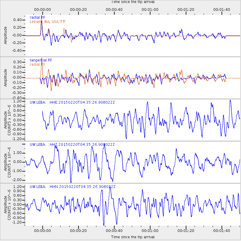
Signal To Noise
| Channel | StoN | STA | LTA |
| UW:LEBA: :HHZ:20150220T04:35:26.908022Z | 2.879831 | 6.596186E-7 | 2.2904766E-7 |
| UW:LEBA: :HHN:20150220T04:35:26.908022Z | 1.147273 | 2.7533318E-7 | 2.3998925E-7 |
| UW:LEBA: :HHE:20150220T04:35:26.908022Z | 0.8440452 | 2.7278077E-7 | 3.2318263E-7 |
| Arrivals |
| Ps | |
| PpPs | |
| PsPs/PpSs | |


