You are here: Home > Network List > II - Global Seismograph Network (GSN - IRIS/IDA) Stations List
> Station PFO Pinon Flat, California, USA > Earthquake Result Viewer
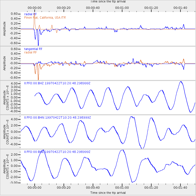
PFO Pinon Flat, California, USA - Earthquake Result Viewer
*The percent match for this event was below the threshold and hence no stack was calculated.
| Earthquake location: |
Windward Islands |
| Earthquake latitude/longitude: |
11.0/-61.0 |
| Earthquake time(UTC): |
1997/04/22 (112) 10:11:44 GMT |
| Earthquake Depth: |
5.0 km |
| Earthquake Magnitude: |
5.6 MB |
| Earthquake Catalog/Contributor: |
WHDF/NEIC |
|
| Network: |
II Global Seismograph Network (GSN - IRIS/IDA) |
| Station: |
PFO Pinon Flat, California, USA |
| Lat/Lon: |
33.61 N/116.46 W |
| Elevation: |
1280 m |
|
| Distance: |
55.3 deg |
| Az: |
303.258 deg |
| Baz: |
100.35 deg |
| Ray Param: |
$rayparam |
*The percent match for this event was below the threshold and hence was not used in the summary stack. |
|
| Radial Match: |
83.67811 % |
| Radial Bump: |
387 |
| Transverse Match: |
50.377377 % |
| Transverse Bump: |
400 |
| SOD ConfigId: |
4480 |
| Insert Time: |
2010-03-01 21:53:03.318 +0000 |
| GWidth: |
2.5 |
| Max Bumps: |
400 |
| Tol: |
0.001 |
|
Signal To Noise
| Channel | StoN | STA | LTA |
| II:PFO:00:BHN:19970422T10:20:48.298999Z | 2.8183002 | 2.1270437E-6 | 7.5472576E-7 |
| II:PFO:00:BHE:19970422T10:20:48.298999Z | 2.407711 | 1.718858E-6 | 7.138972E-7 |
| II:PFO:00:BHZ:19970422T10:20:48.298999Z | 1.9131259 | 2.2216336E-6 | 1.1612585E-6 |
| Arrivals |
| Ps | |
| PpPs | |
| PsPs/PpSs | |


