You are here: Home > Network List > II - Global Seismograph Network (GSN - IRIS/IDA) Stations List
> Station PFO Pinon Flat, California, USA > Earthquake Result Viewer
PFO Pinon Flat, California, USA - Earthquake Result Viewer
*The percent match for this event was below the threshold and hence no stack was calculated.
| Earthquake location: |
Mariana Islands Region |
| Earthquake latitude/longitude: |
21.8/142.6 |
| Earthquake time(UTC): |
1995/04/08 (098) 17:45:18 GMT |
| Earthquake Depth: |
319 km |
| Earthquake Magnitude: |
6.3 MB |
| Earthquake Catalog/Contributor: |
WHDF/NEIC |
|
| Network: |
II Global Seismograph Network (GSN - IRIS/IDA) |
| Station: |
PFO Pinon Flat, California, USA |
| Lat/Lon: |
33.61 N/116.46 W |
| Elevation: |
1280 m |
|
| Distance: |
86.8 deg |
| Az: |
55.162 deg |
| Baz: |
293.939 deg |
| Ray Param: |
$rayparam |
*The percent match for this event was below the threshold and hence was not used in the summary stack. |
|
| Radial Match: |
82.18057 % |
| Radial Bump: |
400 |
| Transverse Match: |
81.80194 % |
| Transverse Bump: |
400 |
| SOD ConfigId: |
4480 |
| Insert Time: |
2010-03-01 21:53:15.637 +0000 |
| GWidth: |
2.5 |
| Max Bumps: |
400 |
| Tol: |
0.001 |
|
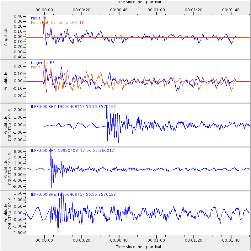
Signal To Noise
| Channel | StoN | STA | LTA |
| II:PFO:00:BHN:19950408T17:56:55.36001Z | 13.249742 | 3.3729896E-6 | 2.545702E-7 |
| II:PFO:00:BHE:19950408T17:56:55.357019Z | 1.4937809 | 3.704421E-7 | 2.479896E-7 |
| II:PFO:00:BHZ:19950408T17:56:55.357019Z | 4.8942533 | 8.123398E-7 | 1.6597829E-7 |
| Arrivals |
| Ps | |
| PpPs | |
| PsPs/PpSs | |


