You are here: Home > Network List > LD - Lamont-Doherty Cooperative Seismographic Network Stations List
> Station MVL Millersville University, PA > Earthquake Result Viewer
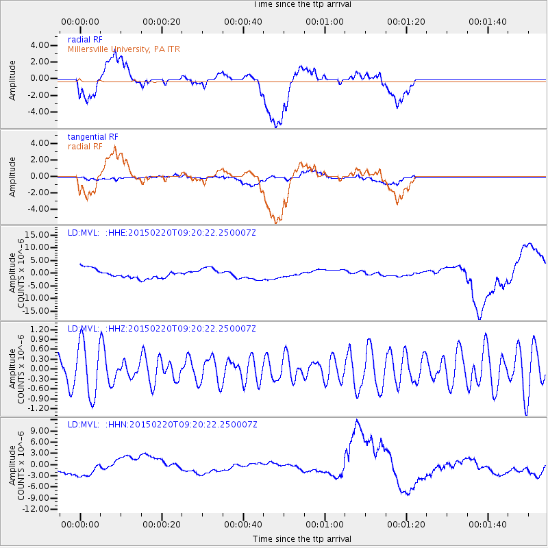
MVL Millersville University, PA - Earthquake Result Viewer
*The percent match for this event was below the threshold and hence no stack was calculated.
| Earthquake location: |
Southern Mid-Atlantic Ridge |
| Earthquake latitude/longitude: |
-22.8/-13.3 |
| Earthquake time(UTC): |
2015/02/20 (051) 09:08:14 GMT |
| Earthquake Depth: |
10 km |
| Earthquake Magnitude: |
5.2 MW |
| Earthquake Catalog/Contributor: |
ISC/ISC |
|
| Network: |
LD Lamont-Doherty Cooperative Seismographic Network |
| Station: |
MVL Millersville University, PA |
| Lat/Lon: |
40.00 N/76.35 W |
| Elevation: |
91 m |
|
| Distance: |
85.7 deg |
| Az: |
316.627 deg |
| Baz: |
124.404 deg |
| Ray Param: |
$rayparam |
*The percent match for this event was below the threshold and hence was not used in the summary stack. |
|
| Radial Match: |
15.511636 % |
| Radial Bump: |
400 |
| Transverse Match: |
26.018473 % |
| Transverse Bump: |
400 |
| SOD ConfigId: |
7019011 |
| Insert Time: |
2019-04-16 23:35:36.216 +0000 |
| GWidth: |
2.5 |
| Max Bumps: |
400 |
| Tol: |
0.001 |
|
Signal To Noise
| Channel | StoN | STA | LTA |
| LD:MVL: :HHZ:20150220T09:20:22.250007Z | 2.0264447 | 8.2209544E-7 | 4.056836E-7 |
| LD:MVL: :HHN:20150220T09:20:22.250007Z | 1.6351993 | 2.7191159E-6 | 1.6628651E-6 |
| LD:MVL: :HHE:20150220T09:20:22.250007Z | 1.3229392 | 2.2485244E-6 | 1.699643E-6 |
| Arrivals |
| Ps | |
| PpPs | |
| PsPs/PpSs | |


