You are here: Home > Network List > II - Global Seismograph Network (GSN - IRIS/IDA) Stations List
> Station PFO Pinon Flat, California, USA > Earthquake Result Viewer
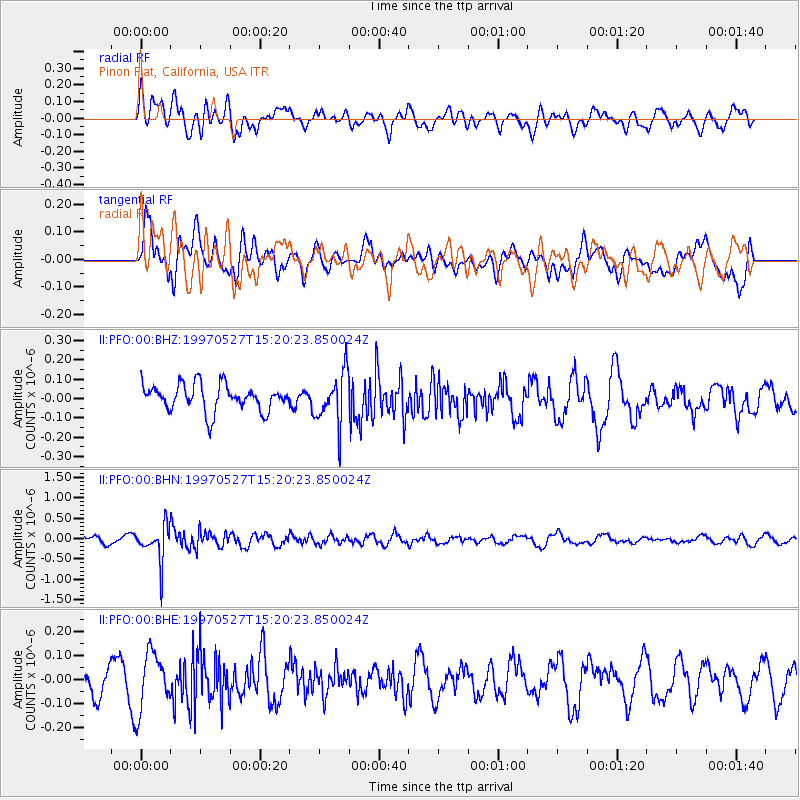
PFO Pinon Flat, California, USA - Earthquake Result Viewer
*The percent match for this event was below the threshold and hence no stack was calculated.
| Earthquake location: |
Mariana Islands |
| Earthquake latitude/longitude: |
16.3/145.4 |
| Earthquake time(UTC): |
1997/05/27 (147) 15:09:03 GMT |
| Earthquake Depth: |
536 km |
| Earthquake Magnitude: |
5.5 MB, 5.6 UNKNOWN, 5.6 MW |
| Earthquake Catalog/Contributor: |
WHDF/NEIC |
|
| Network: |
II Global Seismograph Network (GSN - IRIS/IDA) |
| Station: |
PFO Pinon Flat, California, USA |
| Lat/Lon: |
33.61 N/116.46 W |
| Elevation: |
1280 m |
|
| Distance: |
87.7 deg |
| Az: |
55.782 deg |
| Baz: |
287.936 deg |
| Ray Param: |
$rayparam |
*The percent match for this event was below the threshold and hence was not used in the summary stack. |
|
| Radial Match: |
51.812317 % |
| Radial Bump: |
400 |
| Transverse Match: |
55.558624 % |
| Transverse Bump: |
400 |
| SOD ConfigId: |
4480 |
| Insert Time: |
2010-03-01 21:53:30.460 +0000 |
| GWidth: |
2.5 |
| Max Bumps: |
400 |
| Tol: |
0.001 |
|
Signal To Noise
| Channel | StoN | STA | LTA |
| II:PFO:00:BHN:19970527T15:20:23.850024Z | 5.6975107 | 4.485609E-7 | 7.872927E-8 |
| II:PFO:00:BHE:19970527T15:20:23.850024Z | 1.8206289 | 1.1655118E-7 | 6.401699E-8 |
| II:PFO:00:BHZ:19970527T15:20:23.850024Z | 1.9661323 | 1.347691E-7 | 6.854528E-8 |
| Arrivals |
| Ps | |
| PpPs | |
| PsPs/PpSs | |


