You are here: Home > Network List > II - Global Seismograph Network (GSN - IRIS/IDA) Stations List
> Station PFO Pinon Flat, California, USA > Earthquake Result Viewer
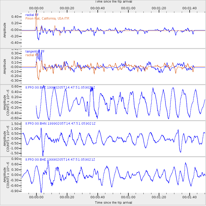
PFO Pinon Flat, California, USA - Earthquake Result Viewer
*The percent match for this event was below the threshold and hence no stack was calculated.
| Earthquake location: |
Northwest Of Kuril Islands |
| Earthquake latitude/longitude: |
47.5/147.2 |
| Earthquake time(UTC): |
1999/02/05 (036) 14:37:53 GMT |
| Earthquake Depth: |
407 km |
| Earthquake Magnitude: |
6.0 MW, 5.4 MB, 5.8 MW |
| Earthquake Catalog/Contributor: |
WHDF/NEIC |
|
| Network: |
II Global Seismograph Network (GSN - IRIS/IDA) |
| Station: |
PFO Pinon Flat, California, USA |
| Lat/Lon: |
33.61 N/116.46 W |
| Elevation: |
1280 m |
|
| Distance: |
70.0 deg |
| Az: |
61.957 deg |
| Baz: |
314.19 deg |
| Ray Param: |
$rayparam |
*The percent match for this event was below the threshold and hence was not used in the summary stack. |
|
| Radial Match: |
65.655624 % |
| Radial Bump: |
400 |
| Transverse Match: |
69.83658 % |
| Transverse Bump: |
400 |
| SOD ConfigId: |
4480 |
| Insert Time: |
2010-03-01 21:53:34.501 +0000 |
| GWidth: |
2.5 |
| Max Bumps: |
400 |
| Tol: |
0.001 |
|
Signal To Noise
| Channel | StoN | STA | LTA |
| II:PFO:00:BHN:19990205T14:47:51.059021Z | 2.0252862 | 7.0795517E-7 | 3.495581E-7 |
| II:PFO:00:BHE:19990205T14:47:51.059021Z | 3.166302 | 4.7055752E-7 | 1.4861422E-7 |
| II:PFO:00:BHZ:19990205T14:47:51.059021Z | 0.6051867 | 2.3243004E-7 | 3.8406336E-7 |
| Arrivals |
| Ps | |
| PpPs | |
| PsPs/PpSs | |


