You are here: Home > Network List > TA - USArray Transportable Network (new EarthScope stations) Stations List
> Station U57A Blanch, NC, USA > Earthquake Result Viewer
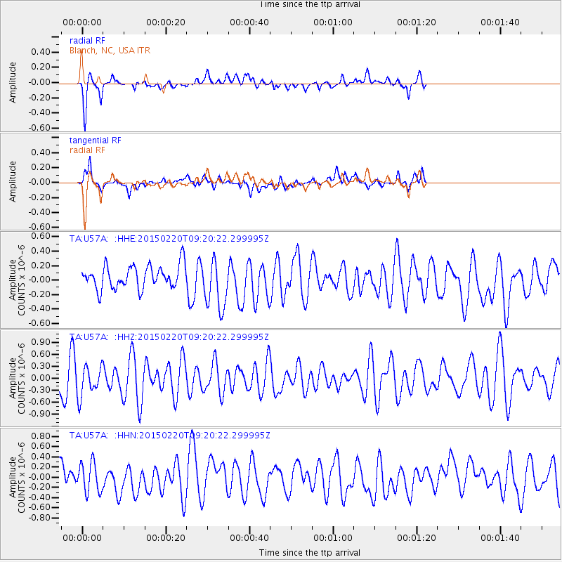
U57A Blanch, NC, USA - Earthquake Result Viewer
*The percent match for this event was below the threshold and hence no stack was calculated.
| Earthquake location: |
Southern Mid-Atlantic Ridge |
| Earthquake latitude/longitude: |
-22.8/-13.3 |
| Earthquake time(UTC): |
2015/02/20 (051) 09:08:14 GMT |
| Earthquake Depth: |
10 km |
| Earthquake Magnitude: |
5.2 MW |
| Earthquake Catalog/Contributor: |
ISC/ISC |
|
| Network: |
TA USArray Transportable Network (new EarthScope stations) |
| Station: |
U57A Blanch, NC, USA |
| Lat/Lon: |
36.43 N/79.34 W |
| Elevation: |
178 m |
|
| Distance: |
85.7 deg |
| Az: |
312.347 deg |
| Baz: |
122.245 deg |
| Ray Param: |
$rayparam |
*The percent match for this event was below the threshold and hence was not used in the summary stack. |
|
| Radial Match: |
65.70243 % |
| Radial Bump: |
400 |
| Transverse Match: |
57.24267 % |
| Transverse Bump: |
400 |
| SOD ConfigId: |
7019011 |
| Insert Time: |
2019-04-16 23:37:40.217 +0000 |
| GWidth: |
2.5 |
| Max Bumps: |
400 |
| Tol: |
0.001 |
|
Signal To Noise
| Channel | StoN | STA | LTA |
| TA:U57A: :HHZ:20150220T09:20:22.299995Z | 0.8986637 | 3.755735E-7 | 4.1792444E-7 |
| TA:U57A: :HHN:20150220T09:20:22.299995Z | 1.2926315 | 2.9646168E-7 | 2.293474E-7 |
| TA:U57A: :HHE:20150220T09:20:22.299995Z | 2.2233994 | 3.5148955E-7 | 1.5808656E-7 |
| Arrivals |
| Ps | |
| PpPs | |
| PsPs/PpSs | |


