You are here: Home > Network List > TA - USArray Transportable Network (new EarthScope stations) Stations List
> Station R11A Troy Canyon, Currant, NV, USA > Earthquake Result Viewer
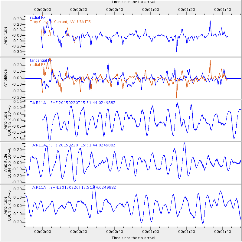
R11A Troy Canyon, Currant, NV, USA - Earthquake Result Viewer
*The percent match for this event was below the threshold and hence no stack was calculated.
| Earthquake location: |
Kermadec Islands Region |
| Earthquake latitude/longitude: |
-31.2/-178.2 |
| Earthquake time(UTC): |
2015/02/20 (051) 15:39:17 GMT |
| Earthquake Depth: |
35 km |
| Earthquake Magnitude: |
5.1 MW |
| Earthquake Catalog/Contributor: |
ISC/ISC |
|
| Network: |
TA USArray Transportable Network (new EarthScope stations) |
| Station: |
R11A Troy Canyon, Currant, NV, USA |
| Lat/Lon: |
38.35 N/115.59 W |
| Elevation: |
1756 m |
|
| Distance: |
90.5 deg |
| Az: |
44.306 deg |
| Baz: |
229.603 deg |
| Ray Param: |
$rayparam |
*The percent match for this event was below the threshold and hence was not used in the summary stack. |
|
| Radial Match: |
47.093655 % |
| Radial Bump: |
400 |
| Transverse Match: |
48.600033 % |
| Transverse Bump: |
400 |
| SOD ConfigId: |
7019011 |
| Insert Time: |
2019-04-16 23:43:41.289 +0000 |
| GWidth: |
2.5 |
| Max Bumps: |
400 |
| Tol: |
0.001 |
|
Signal To Noise
| Channel | StoN | STA | LTA |
| TA:R11A: :BHZ:20150220T15:51:44.024988Z | 1.4642723 | 1.7011023E-7 | 1.161739E-7 |
| TA:R11A: :BHN:20150220T15:51:44.024988Z | 0.40151796 | 4.116321E-8 | 1.0251898E-7 |
| TA:R11A: :BHE:20150220T15:51:44.024988Z | 0.84859276 | 6.184897E-8 | 7.288416E-8 |
| Arrivals |
| Ps | |
| PpPs | |
| PsPs/PpSs | |


