You are here: Home > Network List > UW - Pacific Northwest Regional Seismic Network Stations List
> Station UMAT Pilot Rock, OR, USA > Earthquake Result Viewer
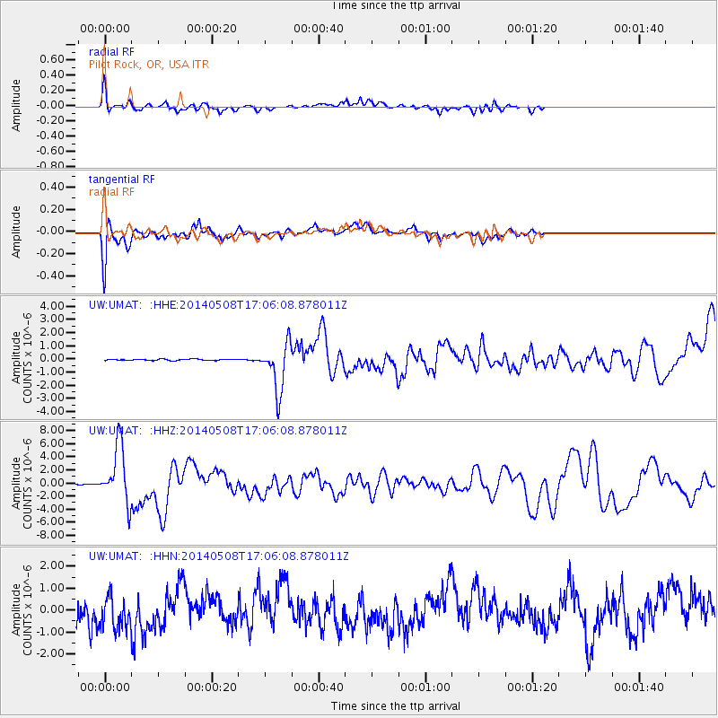
UMAT Pilot Rock, OR, USA - Earthquake Result Viewer
*The percent match for this event was below the threshold and hence no stack was calculated.
| Earthquake location: |
Guerrero, Mexico |
| Earthquake latitude/longitude: |
17.4/-100.7 |
| Earthquake time(UTC): |
2014/05/08 (128) 17:00:17 GMT |
| Earthquake Depth: |
24 km |
| Earthquake Magnitude: |
6.4 MWW, 6.8 MI |
| Earthquake Catalog/Contributor: |
NEIC PDE/NEIC COMCAT |
|
| Network: |
UW Pacific Northwest Regional Seismic Network |
| Station: |
UMAT Pilot Rock, OR, USA |
| Lat/Lon: |
45.29 N/118.96 W |
| Elevation: |
1318 m |
|
| Distance: |
31.8 deg |
| Az: |
335.089 deg |
| Baz: |
145.265 deg |
| Ray Param: |
$rayparam |
*The percent match for this event was below the threshold and hence was not used in the summary stack. |
|
| Radial Match: |
61.723804 % |
| Radial Bump: |
400 |
| Transverse Match: |
74.704414 % |
| Transverse Bump: |
400 |
| SOD ConfigId: |
626651 |
| Insert Time: |
2014-05-22 17:54:23.999 +0000 |
| GWidth: |
2.5 |
| Max Bumps: |
400 |
| Tol: |
0.001 |
|
Signal To Noise
| Channel | StoN | STA | LTA |
| UW:UMAT: :HHZ:20140508T17:06:08.878011Z | 70.45182 | 4.4010662E-6 | 6.246916E-8 |
| UW:UMAT: :HHN:20140508T17:06:08.878011Z | 0.82853514 | 9.84841E-7 | 1.1886533E-6 |
| UW:UMAT: :HHE:20140508T17:06:08.878011Z | 36.290993 | 1.8568974E-6 | 5.1166896E-8 |
| Arrivals |
| Ps | |
| PpPs | |
| PsPs/PpSs | |


