KURK Kurchatov, Kazakhstan - Earthquake Result Viewer
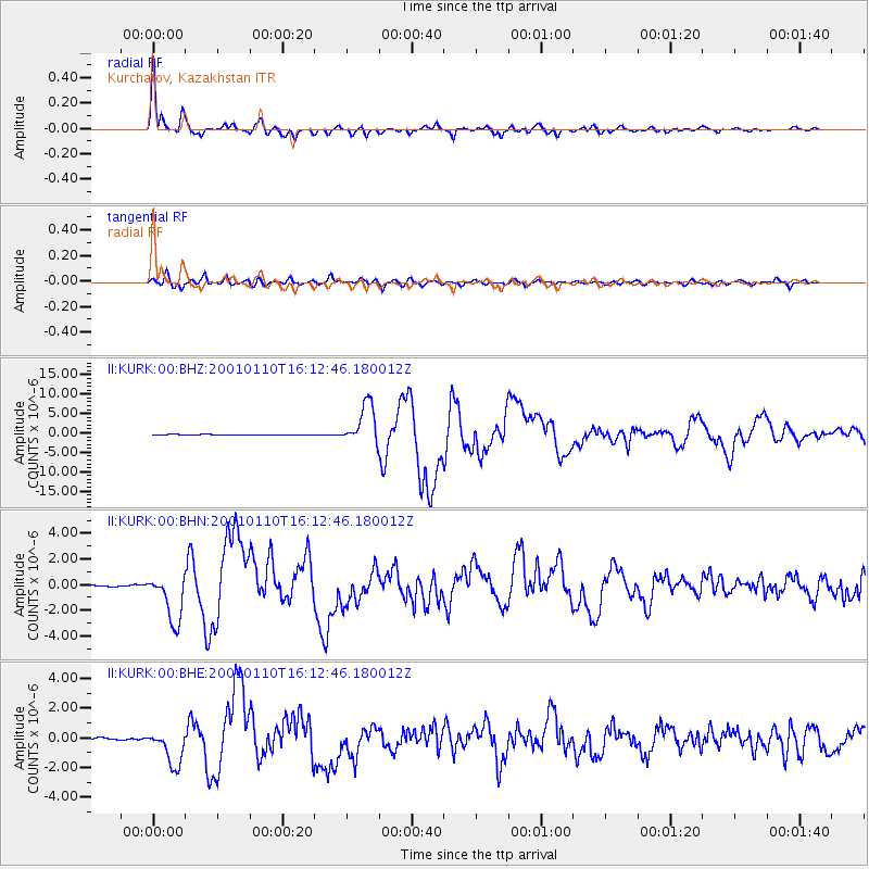
Earthquake location: Kodiak Island Region, Alaska
Earthquake latitude/longitude: 57.1/-153.2
Earthquake time(UTC): 2001/01/10 (010) 16:02:44 GMT
Earthquake Depth: 33 km
Earthquake Magnitude: 6.2 MB, 6.8 MS, 7.1 MW, 6.8 ML
Earthquake Catalog/Contributor: WHDF/NEIC
Network: II Global Seismograph Network (GSN - IRIS/IDA)
Station: KURK Kurchatov, Kazakhstan
Lat/Lon: 50.72 N/78.62 E
Elevation: 184 m
Distance: 64.4 deg
Az: 326.343 deg
Baz: 28.429 deg
Ray Param: 0.058896065
Estimated Moho Depth: 41.0 km
Estimated Crust Vp/Vs: 1.69
Assumed Crust Vp: 6.552 km/s
Estimated Crust Vs: 3.871 km/s
Estimated Crust Poisson's Ratio: 0.23
Radial Match: 98.21207 %
Radial Bump: 381
Transverse Match: 91.993286 %
Transverse Bump: 400
SOD ConfigId: 3744
Insert Time: 2010-03-01 21:55:12.397 +0000
GWidth: 2.5
Max Bumps: 400
Tol: 0.001

Signal To Noise

ChannelStoNSTALTA
II:KURK:00:BHN:20010110T16:12:46.180012Z14.9020411.876581E-61.2592778E-7
II:KURK:00:BHE:20010110T16:12:46.180012Z16.7867151.2094924E-67.2050575E-8
II:KURK:00:BHZ:20010110T16:12:46.180012Z52.403955.2939195E-61.0102139E-7
Arrivals
Ps4.5 SECOND
PpPs16 SECOND
PsPs/PpSs21 SECOND