
KURK Kurchatov, Kazakhstan - Earthquake Result Viewer
| ||||||||||||||||||
| ||||||||||||||||||
| ||||||||||||||||||
|
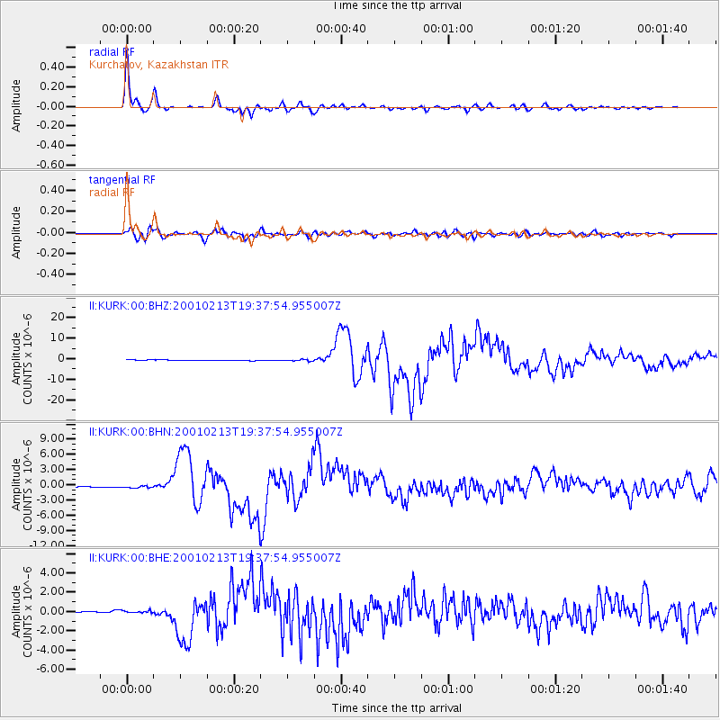
Signal To Noise
| Channel | StoN | STA | LTA |
| II:KURK:00:BHN:20010213T19:37:54.955007Z | 1.7617303 | 2.3207804E-7 | 1.31733E-7 |
| II:KURK:00:BHE:20010213T19:37:54.955007Z | 2.161137 | 1.1426696E-7 | 5.287354E-8 |
| II:KURK:00:BHZ:20010213T19:37:54.955007Z | 2.5796685 | 4.2226614E-7 | 1.6369007E-7 |
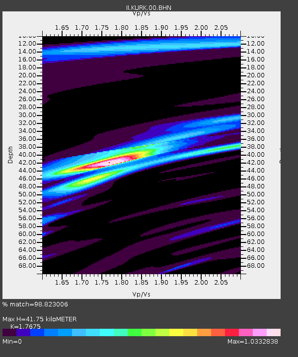
| Arrivals | |
| Ps | 5.1 SECOND |
| PpPs | 17 SECOND |
| PsPs/PpSs | 22 SECOND |

