You are here: Home > Network List > CI - Caltech Regional Seismic Network Stations List
> Station MPM Manuel Prospect Mine, California, USA > Earthquake Result Viewer
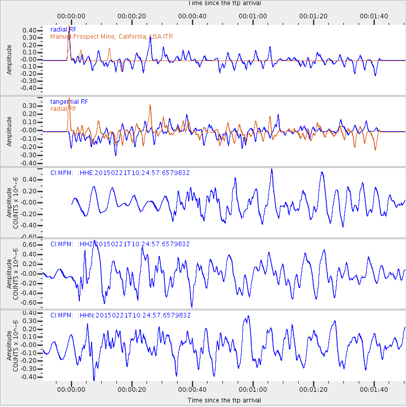
MPM Manuel Prospect Mine, California, USA - Earthquake Result Viewer
*The percent match for this event was below the threshold and hence no stack was calculated.
| Earthquake location: |
Off East Coast Of Honshu, Japan |
| Earthquake latitude/longitude: |
39.9/143.4 |
| Earthquake time(UTC): |
2015/02/21 (052) 10:13:54 GMT |
| Earthquake Depth: |
10 km |
| Earthquake Magnitude: |
6.1 MO |
| Earthquake Catalog/Contributor: |
NEIC PDE/NEIC ALERT |
|
| Network: |
CI Caltech Regional Seismic Network |
| Station: |
MPM Manuel Prospect Mine, California, USA |
| Lat/Lon: |
36.06 N/117.49 W |
| Elevation: |
185 m |
|
| Distance: |
74.0 deg |
| Az: |
56.343 deg |
| Baz: |
307.752 deg |
| Ray Param: |
$rayparam |
*The percent match for this event was below the threshold and hence was not used in the summary stack. |
|
| Radial Match: |
71.12394 % |
| Radial Bump: |
400 |
| Transverse Match: |
53.893425 % |
| Transverse Bump: |
400 |
| SOD ConfigId: |
7019011 |
| Insert Time: |
2019-04-16 23:58:19.593 +0000 |
| GWidth: |
2.5 |
| Max Bumps: |
400 |
| Tol: |
0.001 |
|
Signal To Noise
| Channel | StoN | STA | LTA |
| CI:MPM: :HHZ:20150221T10:24:57.657983Z | 3.4982111 | 2.3719348E-7 | 6.780422E-8 |
| CI:MPM: :HHN:20150221T10:24:57.657983Z | 1.3411807 | 1.499351E-7 | 1.1179336E-7 |
| CI:MPM: :HHE:20150221T10:24:57.657983Z | 1.155163 | 1.4716134E-7 | 1.2739443E-7 |
| Arrivals |
| Ps | |
| PpPs | |
| PsPs/PpSs | |


