You are here: Home > Network List > CN - Canadian National Seismograph Network Stations List
> Station INK INUVIK, NT > Earthquake Result Viewer
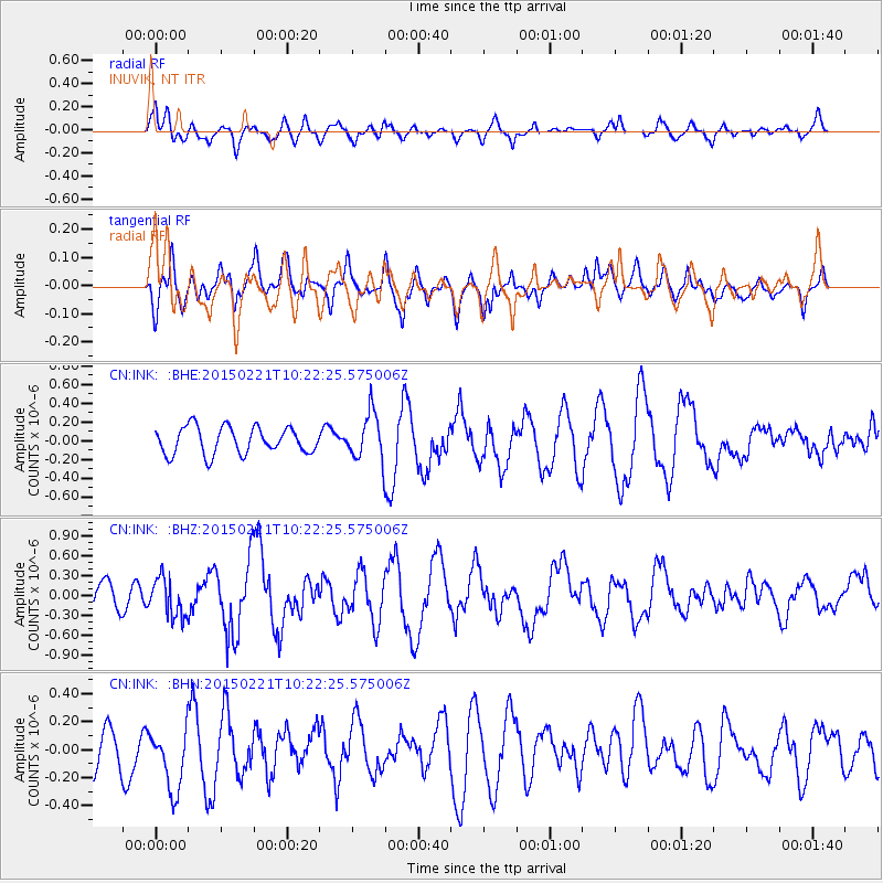
INK INUVIK, NT - Earthquake Result Viewer
*The percent match for this event was below the threshold and hence no stack was calculated.
| Earthquake location: |
Off East Coast Of Honshu, Japan |
| Earthquake latitude/longitude: |
39.9/143.4 |
| Earthquake time(UTC): |
2015/02/21 (052) 10:13:54 GMT |
| Earthquake Depth: |
10 km |
| Earthquake Magnitude: |
6.1 MO |
| Earthquake Catalog/Contributor: |
NEIC PDE/NEIC ALERT |
|
| Network: |
CN Canadian National Seismograph Network |
| Station: |
INK INUVIK, NT |
| Lat/Lon: |
68.31 N/133.53 W |
| Elevation: |
44 m |
|
| Distance: |
51.2 deg |
| Az: |
28.287 deg |
| Baz: |
281.172 deg |
| Ray Param: |
$rayparam |
*The percent match for this event was below the threshold and hence was not used in the summary stack. |
|
| Radial Match: |
68.07744 % |
| Radial Bump: |
400 |
| Transverse Match: |
47.669357 % |
| Transverse Bump: |
400 |
| SOD ConfigId: |
7019011 |
| Insert Time: |
2019-04-16 23:58:46.324 +0000 |
| GWidth: |
2.5 |
| Max Bumps: |
400 |
| Tol: |
0.001 |
|
Signal To Noise
| Channel | StoN | STA | LTA |
| CN:INK: :BHZ:20150221T10:22:25.575006Z | 1.062232 | 2.914813E-7 | 2.7440456E-7 |
| CN:INK: :BHN:20150221T10:22:25.575006Z | 1.1747559 | 2.527913E-7 | 2.1518623E-7 |
| CN:INK: :BHE:20150221T10:22:25.575006Z | 2.1734953 | 3.1090062E-7 | 1.4304176E-7 |
| Arrivals |
| Ps | |
| PpPs | |
| PsPs/PpSs | |


