You are here: Home > Network List > US - United States National Seismic Network Stations List
> Station DGMT Dagmar, Montana, USA > Earthquake Result Viewer
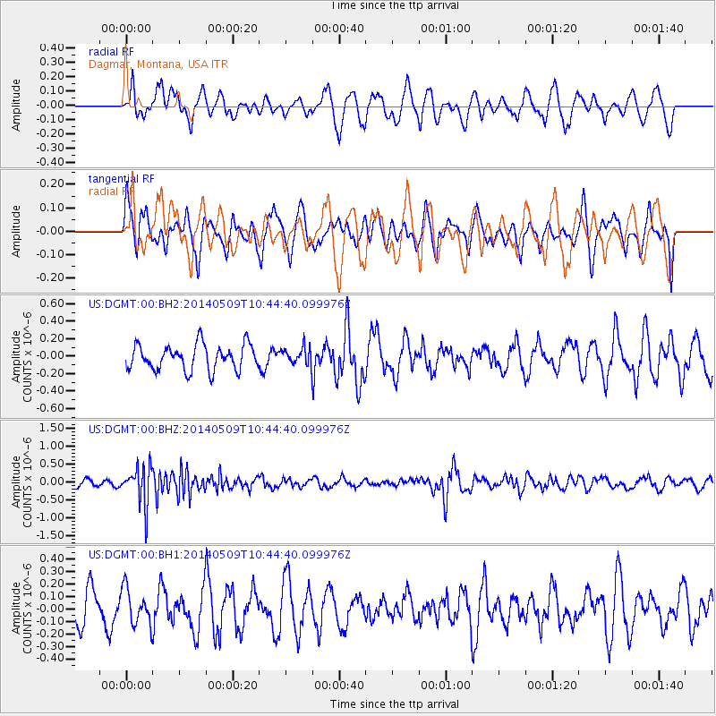
DGMT Dagmar, Montana, USA - Earthquake Result Viewer
*The percent match for this event was below the threshold and hence no stack was calculated.
| Earthquake location: |
Tonga Islands |
| Earthquake latitude/longitude: |
-18.9/-175.6 |
| Earthquake time(UTC): |
2014/05/09 (129) 10:32:18 GMT |
| Earthquake Depth: |
153 km |
| Earthquake Magnitude: |
5.8 MWP |
| Earthquake Catalog/Contributor: |
NEIC PDE/NEIC COMCAT |
|
| Network: |
US United States National Seismic Network |
| Station: |
DGMT Dagmar, Montana, USA |
| Lat/Lon: |
48.47 N/104.20 W |
| Elevation: |
0.0 m |
|
| Distance: |
92.3 deg |
| Az: |
39.144 deg |
| Baz: |
243.886 deg |
| Ray Param: |
$rayparam |
*The percent match for this event was below the threshold and hence was not used in the summary stack. |
|
| Radial Match: |
39.76831 % |
| Radial Bump: |
343 |
| Transverse Match: |
39.959538 % |
| Transverse Bump: |
385 |
| SOD ConfigId: |
626651 |
| Insert Time: |
2014-05-23 11:20:59.534 +0000 |
| GWidth: |
2.5 |
| Max Bumps: |
400 |
| Tol: |
0.001 |
|
Signal To Noise
| Channel | StoN | STA | LTA |
| US:DGMT:00:BHZ:20140509T10:44:40.099976Z | 6.040606 | 5.279608E-7 | 8.7401965E-8 |
| US:DGMT:00:BH1:20140509T10:44:40.099976Z | 0.9354353 | 1.4280876E-7 | 1.5266556E-7 |
| US:DGMT:00:BH2:20140509T10:44:40.099976Z | 0.6540558 | 9.5366175E-8 | 1.458074E-7 |
| Arrivals |
| Ps | |
| PpPs | |
| PsPs/PpSs | |


