You are here: Home > Network List > US - United States National Seismic Network Stations List
> Station EGMT Eagleton, Montana, USA > Earthquake Result Viewer
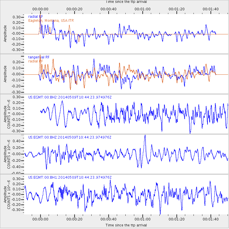
EGMT Eagleton, Montana, USA - Earthquake Result Viewer
*The percent match for this event was below the threshold and hence no stack was calculated.
| Earthquake location: |
Tonga Islands |
| Earthquake latitude/longitude: |
-18.9/-175.6 |
| Earthquake time(UTC): |
2014/05/09 (129) 10:32:18 GMT |
| Earthquake Depth: |
153 km |
| Earthquake Magnitude: |
5.8 MWP |
| Earthquake Catalog/Contributor: |
NEIC PDE/NEIC COMCAT |
|
| Network: |
US United States National Seismic Network |
| Station: |
EGMT Eagleton, Montana, USA |
| Lat/Lon: |
48.02 N/109.75 W |
| Elevation: |
1055 m |
|
| Distance: |
88.8 deg |
| Az: |
37.783 deg |
| Baz: |
239.762 deg |
| Ray Param: |
$rayparam |
*The percent match for this event was below the threshold and hence was not used in the summary stack. |
|
| Radial Match: |
44.306545 % |
| Radial Bump: |
400 |
| Transverse Match: |
48.242634 % |
| Transverse Bump: |
400 |
| SOD ConfigId: |
626651 |
| Insert Time: |
2014-05-23 11:21:11.344 +0000 |
| GWidth: |
2.5 |
| Max Bumps: |
400 |
| Tol: |
0.001 |
|
Signal To Noise
| Channel | StoN | STA | LTA |
| US:EGMT:00:BHZ:20140509T10:44:23.974976Z | 2.6187205 | 1.6946987E-7 | 6.471476E-8 |
| US:EGMT:00:BH1:20140509T10:44:23.974976Z | 1.1713029 | 1.0615809E-7 | 9.063248E-8 |
| US:EGMT:00:BH2:20140509T10:44:23.974976Z | 1.3444606 | 1.3755422E-7 | 1.0231183E-7 |
| Arrivals |
| Ps | |
| PpPs | |
| PsPs/PpSs | |


