You are here: Home > Network List > US - United States National Seismic Network Stations List
> Station MIAR Mount Ida, Arkansas, USA > Earthquake Result Viewer
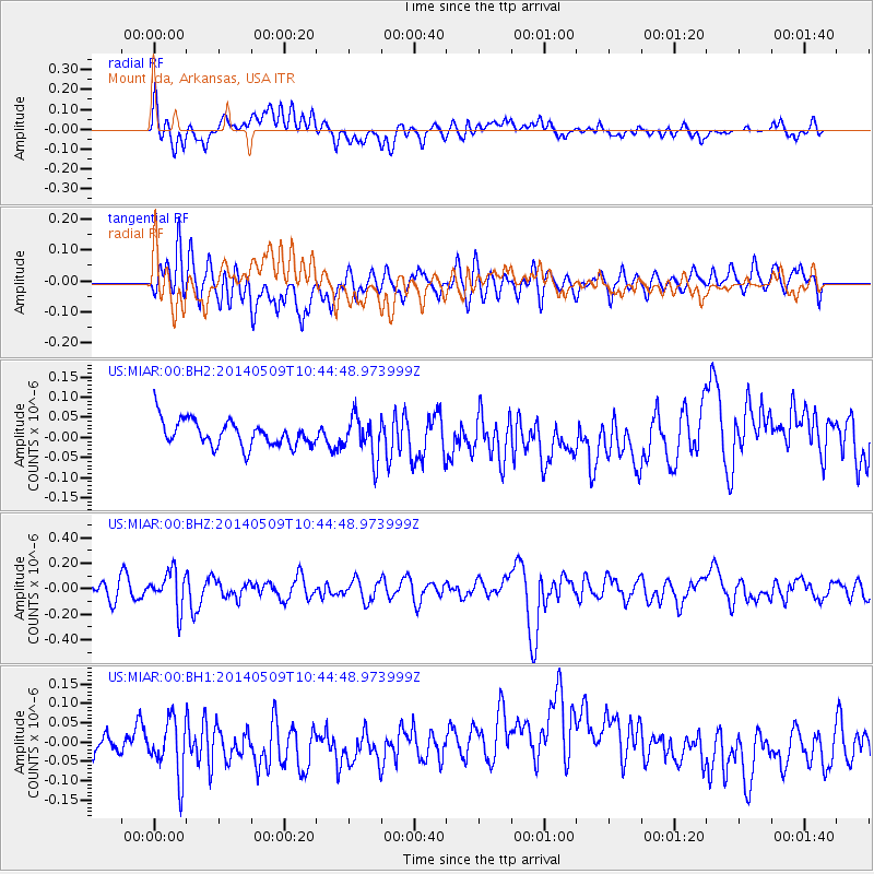
MIAR Mount Ida, Arkansas, USA - Earthquake Result Viewer
*The percent match for this event was below the threshold and hence no stack was calculated.
| Earthquake location: |
Tonga Islands |
| Earthquake latitude/longitude: |
-18.9/-175.6 |
| Earthquake time(UTC): |
2014/05/09 (129) 10:32:18 GMT |
| Earthquake Depth: |
153 km |
| Earthquake Magnitude: |
5.8 MWP |
| Earthquake Catalog/Contributor: |
NEIC PDE/NEIC COMCAT |
|
| Network: |
US United States National Seismic Network |
| Station: |
MIAR Mount Ida, Arkansas, USA |
| Lat/Lon: |
34.55 N/93.58 W |
| Elevation: |
207 m |
|
| Distance: |
94.2 deg |
| Az: |
55.054 deg |
| Baz: |
250.054 deg |
| Ray Param: |
$rayparam |
*The percent match for this event was below the threshold and hence was not used in the summary stack. |
|
| Radial Match: |
39.37478 % |
| Radial Bump: |
400 |
| Transverse Match: |
50.569855 % |
| Transverse Bump: |
400 |
| SOD ConfigId: |
626651 |
| Insert Time: |
2014-05-23 11:21:49.864 +0000 |
| GWidth: |
2.5 |
| Max Bumps: |
400 |
| Tol: |
0.001 |
|
Signal To Noise
| Channel | StoN | STA | LTA |
| US:MIAR:00:BHZ:20140509T10:44:48.973999Z | 1.9112629 | 1.4452205E-7 | 7.5616E-8 |
| US:MIAR:00:BH1:20140509T10:44:48.973999Z | 1.5222977 | 7.198717E-8 | 4.728849E-8 |
| US:MIAR:00:BH2:20140509T10:44:48.973999Z | 1.5634848 | 5.0335643E-8 | 3.219452E-8 |
| Arrivals |
| Ps | |
| PpPs | |
| PsPs/PpSs | |


