You are here: Home > Network List > TA - USArray Transportable Network (new EarthScope stations) Stations List
> Station O03E Paynes Creek, CA, USA > Earthquake Result Viewer
O03E Paynes Creek, CA, USA - Earthquake Result Viewer
*The percent match for this event was below the threshold and hence no stack was calculated.
| Earthquake location: |
Off East Coast Of Honshu, Japan |
| Earthquake latitude/longitude: |
39.9/143.4 |
| Earthquake time(UTC): |
2015/02/21 (052) 10:13:54 GMT |
| Earthquake Depth: |
10 km |
| Earthquake Magnitude: |
6.1 MO |
| Earthquake Catalog/Contributor: |
NEIC PDE/NEIC ALERT |
|
| Network: |
TA USArray Transportable Network (new EarthScope stations) |
| Station: |
O03E Paynes Creek, CA, USA |
| Lat/Lon: |
40.29 N/121.80 W |
| Elevation: |
967 m |
|
| Distance: |
68.8 deg |
| Az: |
54.862 deg |
| Baz: |
304.621 deg |
| Ray Param: |
$rayparam |
*The percent match for this event was below the threshold and hence was not used in the summary stack. |
|
| Radial Match: |
63.224644 % |
| Radial Bump: |
400 |
| Transverse Match: |
68.42189 % |
| Transverse Bump: |
400 |
| SOD ConfigId: |
7019011 |
| Insert Time: |
2019-04-17 00:03:17.963 +0000 |
| GWidth: |
2.5 |
| Max Bumps: |
400 |
| Tol: |
0.001 |
|
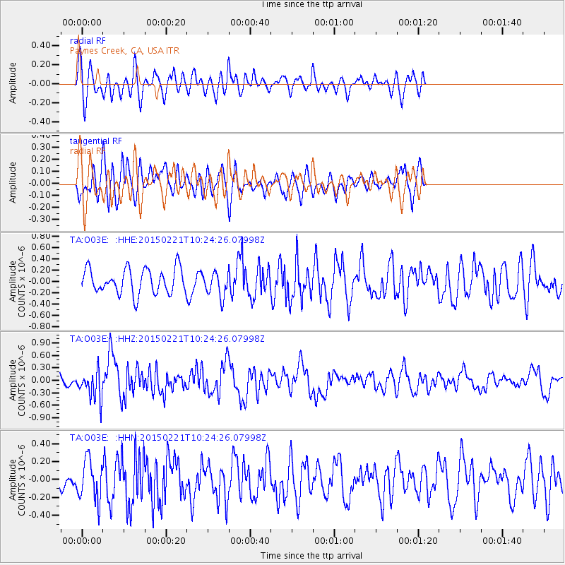
Signal To Noise
| Channel | StoN | STA | LTA |
| TA:O03E: :HHZ:20150221T10:24:26.07998Z | 4.1055446 | 3.5927184E-7 | 8.750894E-8 |
| TA:O03E: :HHN:20150221T10:24:26.07998Z | 2.0205708 | 2.297297E-7 | 1.1369545E-7 |
| TA:O03E: :HHE:20150221T10:24:26.07998Z | 1.0012413 | 2.3106439E-7 | 2.3077793E-7 |
| Arrivals |
| Ps | |
| PpPs | |
| PsPs/PpSs | |


