You are here: Home > Network List > CN - Canadian National Seismograph Network Stations List
> Station INK INUVIK, NT > Earthquake Result Viewer
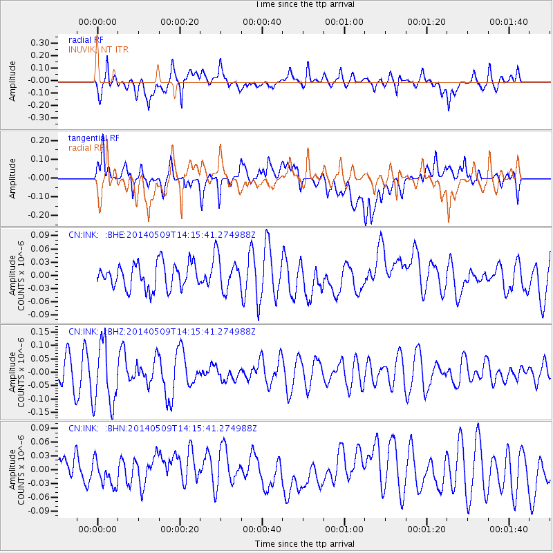
INK INUVIK, NT - Earthquake Result Viewer
*The percent match for this event was below the threshold and hence no stack was calculated.
| Earthquake location: |
Fiji Islands Region |
| Earthquake latitude/longitude: |
-18.4/-178.1 |
| Earthquake time(UTC): |
2014/05/09 (129) 14:03:59 GMT |
| Earthquake Depth: |
528 km |
| Earthquake Magnitude: |
5.6 MB |
| Earthquake Catalog/Contributor: |
NEIC PDE/NEIC COMCAT |
|
| Network: |
CN Canadian National Seismograph Network |
| Station: |
INK INUVIK, NT |
| Lat/Lon: |
68.31 N/133.53 W |
| Elevation: |
44 m |
|
| Distance: |
92.2 deg |
| Az: |
15.124 deg |
| Baz: |
221.796 deg |
| Ray Param: |
$rayparam |
*The percent match for this event was below the threshold and hence was not used in the summary stack. |
|
| Radial Match: |
56.29359 % |
| Radial Bump: |
400 |
| Transverse Match: |
41.04892 % |
| Transverse Bump: |
400 |
| SOD ConfigId: |
626651 |
| Insert Time: |
2014-05-23 14:24:22.664 +0000 |
| GWidth: |
2.5 |
| Max Bumps: |
400 |
| Tol: |
0.001 |
|
Signal To Noise
| Channel | StoN | STA | LTA |
| CN:INK: :BHZ:20140509T14:15:41.274988Z | 2.0470047 | 1.1560679E-7 | 5.6476072E-8 |
| CN:INK: :BHN:20140509T14:15:41.274988Z | 0.6119779 | 2.6608344E-8 | 4.3479258E-8 |
| CN:INK: :BHE:20140509T14:15:41.274988Z | 1.2196449 | 3.461389E-8 | 2.8380303E-8 |
| Arrivals |
| Ps | |
| PpPs | |
| PsPs/PpSs | |


