You are here: Home > Network List > TA - USArray Transportable Network (new EarthScope stations) Stations List
> Station Z41A Richland Creek Farm, El Dorado, AR, USA > Earthquake Result Viewer
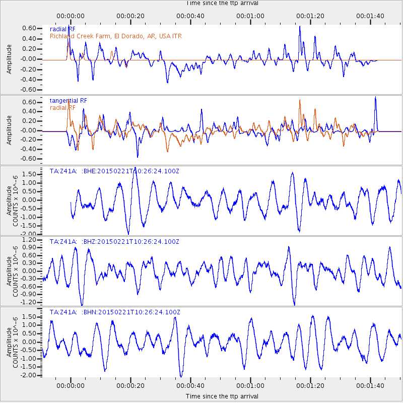
Z41A Richland Creek Farm, El Dorado, AR, USA - Earthquake Result Viewer
*The percent match for this event was below the threshold and hence no stack was calculated.
| Earthquake location: |
Off East Coast Of Honshu, Japan |
| Earthquake latitude/longitude: |
39.9/143.4 |
| Earthquake time(UTC): |
2015/02/21 (052) 10:13:54 GMT |
| Earthquake Depth: |
10 km |
| Earthquake Magnitude: |
6.1 MO |
| Earthquake Catalog/Contributor: |
NEIC PDE/NEIC ALERT |
|
| Network: |
TA USArray Transportable Network (new EarthScope stations) |
| Station: |
Z41A Richland Creek Farm, El Dorado, AR, USA |
| Lat/Lon: |
33.26 N/92.80 W |
| Elevation: |
62 m |
|
| Distance: |
90.6 deg |
| Az: |
44.15 deg |
| Baz: |
320.22 deg |
| Ray Param: |
$rayparam |
*The percent match for this event was below the threshold and hence was not used in the summary stack. |
|
| Radial Match: |
61.828136 % |
| Radial Bump: |
400 |
| Transverse Match: |
61.018738 % |
| Transverse Bump: |
400 |
| SOD ConfigId: |
7019011 |
| Insert Time: |
2019-04-17 00:03:34.492 +0000 |
| GWidth: |
2.5 |
| Max Bumps: |
400 |
| Tol: |
0.001 |
|
Signal To Noise
| Channel | StoN | STA | LTA |
| TA:Z41A: :BHZ:20150221T10:26:24.100Z | 2.4668672 | 7.284509E-7 | 2.9529392E-7 |
| TA:Z41A: :BHN:20150221T10:26:24.100Z | 0.7823149 | 5.580486E-7 | 7.133299E-7 |
| TA:Z41A: :BHE:20150221T10:26:24.100Z | 0.71608514 | 5.9503185E-7 | 8.309513E-7 |
| Arrivals |
| Ps | |
| PpPs | |
| PsPs/PpSs | |


