You are here: Home > Network List > TA - USArray Transportable Network (new EarthScope stations) Stations List
> Station Y12C Blythe, CA, USA > Earthquake Result Viewer
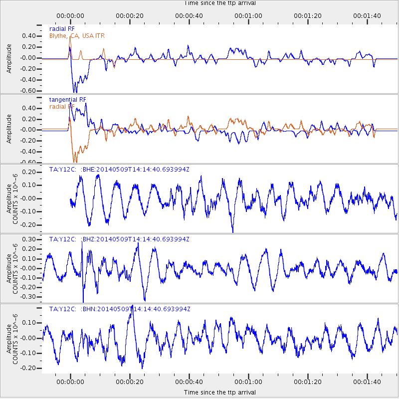
Y12C Blythe, CA, USA - Earthquake Result Viewer
*The percent match for this event was below the threshold and hence no stack was calculated.
| Earthquake location: |
Fiji Islands Region |
| Earthquake latitude/longitude: |
-18.4/-178.1 |
| Earthquake time(UTC): |
2014/05/09 (129) 14:03:59 GMT |
| Earthquake Depth: |
528 km |
| Earthquake Magnitude: |
5.6 MB |
| Earthquake Catalog/Contributor: |
NEIC PDE/NEIC COMCAT |
|
| Network: |
TA USArray Transportable Network (new EarthScope stations) |
| Station: |
Y12C Blythe, CA, USA |
| Lat/Lon: |
33.75 N/114.52 W |
| Elevation: |
196 m |
|
| Distance: |
79.6 deg |
| Az: |
49.302 deg |
| Baz: |
239.795 deg |
| Ray Param: |
$rayparam |
*The percent match for this event was below the threshold and hence was not used in the summary stack. |
|
| Radial Match: |
53.53471 % |
| Radial Bump: |
400 |
| Transverse Match: |
35.682163 % |
| Transverse Bump: |
400 |
| SOD ConfigId: |
626651 |
| Insert Time: |
2014-05-23 14:33:25.146 +0000 |
| GWidth: |
2.5 |
| Max Bumps: |
400 |
| Tol: |
0.001 |
|
Signal To Noise
| Channel | StoN | STA | LTA |
| TA:Y12C: :BHZ:20140509T14:14:40.693994Z | 1.3860788 | 1.2954831E-7 | 9.346389E-8 |
| TA:Y12C: :BHN:20140509T14:14:40.693994Z | 0.8512332 | 1.2332933E-7 | 1.4488313E-7 |
| TA:Y12C: :BHE:20140509T14:14:40.693994Z | 0.42877614 | 4.473718E-8 | 1.0433691E-7 |
| Arrivals |
| Ps | |
| PpPs | |
| PsPs/PpSs | |


