You are here: Home > Network List > US - United States National Seismic Network Stations List
> Station MNTX Cornudas Mountains, Texas, USA > Earthquake Result Viewer
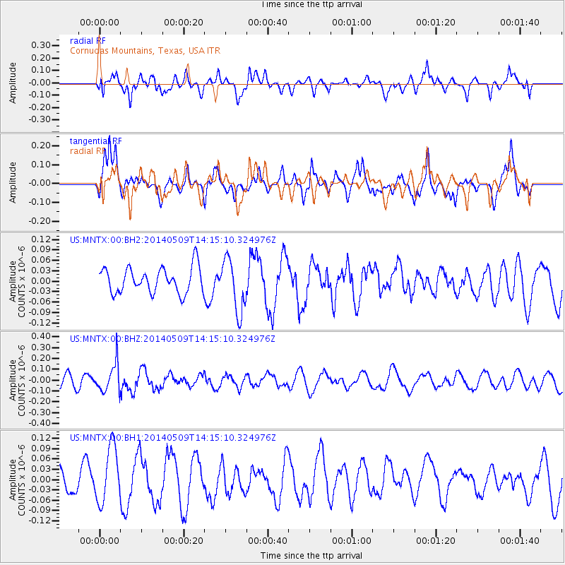
MNTX Cornudas Mountains, Texas, USA - Earthquake Result Viewer
*The percent match for this event was below the threshold and hence no stack was calculated.
| Earthquake location: |
Fiji Islands Region |
| Earthquake latitude/longitude: |
-18.4/-178.1 |
| Earthquake time(UTC): |
2014/05/09 (129) 14:03:59 GMT |
| Earthquake Depth: |
528 km |
| Earthquake Magnitude: |
5.6 MB |
| Earthquake Catalog/Contributor: |
NEIC PDE/NEIC COMCAT |
|
| Network: |
US United States National Seismic Network |
| Station: |
MNTX Cornudas Mountains, Texas, USA |
| Lat/Lon: |
31.70 N/105.38 W |
| Elevation: |
404 m |
|
| Distance: |
85.6 deg |
| Az: |
54.701 deg |
| Baz: |
245.418 deg |
| Ray Param: |
$rayparam |
*The percent match for this event was below the threshold and hence was not used in the summary stack. |
|
| Radial Match: |
54.555267 % |
| Radial Bump: |
400 |
| Transverse Match: |
55.216717 % |
| Transverse Bump: |
400 |
| SOD ConfigId: |
626651 |
| Insert Time: |
2014-05-23 14:34:07.870 +0000 |
| GWidth: |
2.5 |
| Max Bumps: |
400 |
| Tol: |
0.001 |
|
Signal To Noise
| Channel | StoN | STA | LTA |
| US:MNTX:00:BHZ:20140509T14:15:10.324976Z | 2.0188282 | 1.3469626E-7 | 6.672003E-8 |
| US:MNTX:00:BH1:20140509T14:15:10.324976Z | 3.3177996 | 8.480555E-8 | 2.5560782E-8 |
| US:MNTX:00:BH2:20140509T14:15:10.324976Z | 2.1466599 | 7.8221895E-8 | 3.643889E-8 |
| Arrivals |
| Ps | |
| PpPs | |
| PsPs/PpSs | |


